
Manaslu Circuit Trek: An Honest 10-Day Itinerary from a Solo Female Trekker
The view from Larkya La Pass. This is what you walk toward for nine days.
By Karlie Place
I just got back from ten days walking around Manaslu, the eighth highest mountain in the world, and I have a lot to say. This is not a tour company itinerary copy-pasted from a brochure. This is the real, day-by-day, what-actually-happened version, written from the voice memos I recorded on the trail and the photos I shot on a camera I shattered on day two. If you're considering this trek, this is the post I wish I'd had before I went.
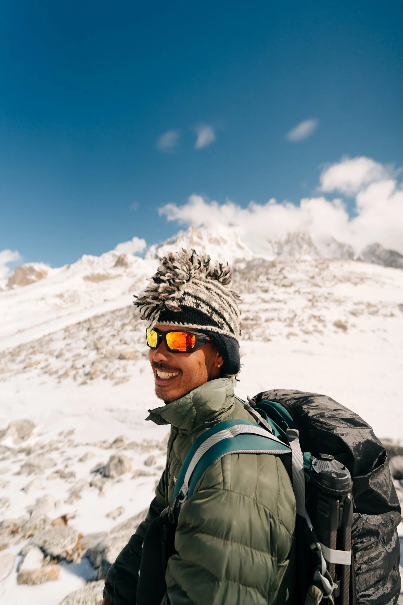
I trekked the Manaslu Circuit with Ecuatraveling from April 21 through May 5, 2026. My guides were Jiwan and Das, two of the most extraordinary humans I have ever met. There were 87.37 miles of trail, 23,892 feet of elevation gain, one helicopter rescue, one Tibetan Buddhist holiday I stumbled into by accident, one shattered LCD screen, and an embarrassing number of moments where I cried in front of mountains. Let's go.
This post contains affiliate links. Booking through my links supports this blog at no extra cost to you.
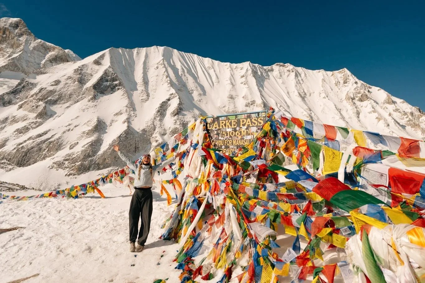
Larkya La Pass, 5,106m. 7:22 AM, May 4, 2026.
What This Trek Actually Is (And Isn't)
Quick clarification because I got asked this a lot: I did not climb Manaslu. The Manaslu Circuit Trek is a roughly 14-day hike that loops around the mountain. You see the peak from every conceivable angle, you cross a 5,106-meter pass called Larkya La, but you don't summit anything, you just walk. Climbing Manaslu itself is more technically difficult than climbing Everest, and very few people attempt it each year. This trek is the slightly-saner cousin: still hard, still high, still wild, but doable for someone like me who'd never been to altitude before in her life.
For context: about 30,000 people a year hike Everest Base Camp. Only around 7,000 do the Manaslu Circuit. It's a restricted area, you legally cannot do it without a licensed guide and a permit, and you need a minimum of two trekkers in your group to even apply. This is part of why it's so quiet, so untouched, and honestly, why I picked it. I wanted an adventure that would actually challenge me. Everest never appealed to me, too crowded, too commodified. Manaslu felt like the trek that still had its dignity.
Travel Days: Salt Lake → Hong Kong → Kathmandu
I flew out of Salt Lake City on Delta to LA, then caught a Cathay Pacific flight from LA to Hong Kong, where I opted into the 12-hour layover option and got an entire day in the city. If you have the choice, take the layover. I rode the Victoria Peak tram, ate a mango mochi, hit a Michelin-starred sago dessert spot, hiked about two miles up to a (very foggy) scenic overlook, grabbed a grape slushie at HEYTEA, and had a peak experience at Halfway Coffee, which I cannot recommend enough after a long-haul flight. Then it was back to the airport for the Cathay flight to Kathmandu.
The arrival in Kathmandu is its own ordeal, and I want to warn you about two things specifically:
Baggage claim is chaotic. I checked my big backpacking bag with everything tucked in, and the bag itself made it through fine. But here's the thing nobody told me: airport staff will sometimes pull bags off the conveyor and stack them on a cart far away from where bags are actually appearing. We stood there for 45 minutes thinking our bags hadn't arrived yet. They had. They were just on a different cart on the other side of the room.
Visa-on-arrival is a vibe. Ecuatraveling told me not to bother doing the visa in advance because their online system can malfunction, so we did it in person. It is first-come-first-served at little kiosk machines with weird Wi-Fi, no one guiding you, and multiple browsers open from previous travelers. You'll need your passport number, trip duration, and intended hotel address in Kathmandu. It's $50 USD. You can pay with cash or with their online system. Paige's online payment went through first try. Mine took three. Take a screenshot of the confirmation screen the moment it works, because the email confirmation can lag behind and the customs officer needs to see proof.
Jiwan and Das picked us up around midnight in a private car and drove us to Roadhouse Hotel Thamel , which would become the bookend of this whole trip. It's in Thamel, the tourist district of Kathmandu, which during the day is full of gorgeous handmade goods and cute cafés and at night becomes a slightly chaotic but very fun neighborhood to walk around. We didn't get to enjoy any of that on arrival because we got there at midnight, but Jiwan ran out and grabbed me momos so I could eat before bed. From the very first night, both guides were emphasizing how important it was that I keep eating real meals, the trek is so physically demanding that you will lose your appetite as you climb, and the food has to go in regardless.
The hotel provides bottled water, which matters because you should not be drinking the tap water in Nepal under any circumstance.
Day 0: Kathmandu → Machha Khola (The 10-Hour Bus Ride)
This day is technically not a hiking day, but it is one of the most memorable days of the entire trip and it absolutely needs to be in this itinerary. We were picked up at 6:20 a.m. Before leaving, Paige and I packed up everything we didn't want to carry on the trek, laptops, extra electronics, neck pillows, anything that wasn't essential, and handed it over to the hotel front desk to be locked in their safe. Tip: bring a separate bag for this. The hotel had a tote we could use, but our things would have been more secure in a proper bag. They give you a claim ticket. I'm not going to be carrying a 16-inch MacBook Pro for 100 miles, you know what I mean?
Then we got into another private car, which drove us to a public bus station that I can only describe as 20+ buses simultaneously loading with passengers and zero apparent organization. This was my first real glimpse of Kathmandu outside the tourist bubble: smoggy, dusty, packed, alive.
And here is the warning I needed and didn't get: book a private jeep transfer to the trailhead instead of taking the public bus. I can't believe nobody told me. The bus has no AC, no doors (they keep them open because it's so hot), tiny overhead bins, and a 10-hour ride along increasingly mountainous, dusty roads. I kept my camera bag in my lap the whole way. Dust hit my eyes constantly, coated everything, and the bus is so packed you can barely shift in your seat. This is the day I started learning that I had been spoiled by 40 countries of relatively comfortable travel.
We stopped about three hours in at a roadside restaurant for a meal. I had cooked chickpeas and fried vegetable noodles. Nepal is incredibly easy if you're vegetarian, a lot of the food culture is shaped by Buddhist influence, so meat-free options are everywhere. Paige is gluten-free, though, and that turned out to be much harder. Soy sauce and wheat sneak into almost everything. She ended up surviving mostly on curry rice and fruit.
The fever-dream details from this bus ride are what I'll remember forever. Locals using the bus as a delivery service, at one point we stopped in a small village for a stretch break, and I watched men loading a mini fridge onto the roof of our bus to be dropped off in a more rural village 45 minutes later. Another stop, our guides got us ice cream by the roadside. At a third stop, a guy stood next to me holding a canvas sack with a live chicken inside. I have been to forty countries and this remains one of the most jarring, wonderful, unique cultural experiences of my life. Maybe I would have handled it better if I hadn't been on hour 36 of travel with three hours of sleep, but I was just deeply, deeply exhausted.
We arrived in Machha Khola at 5 p.m. on the dot, walked down to our first teahouse, Hotel Larke Peak and Restaurant, room 20, and slept for twelve hours.
Machha Khola, the end of the bus ride and the start of the trail.
Breakfast at Hotel Larke Peak, Machha Khola
I woke up to a veggie omelette stuffed with carrots and onions, a coffee with milk, and the first appearance of the most important meal of this entire trek: the fruit plate.
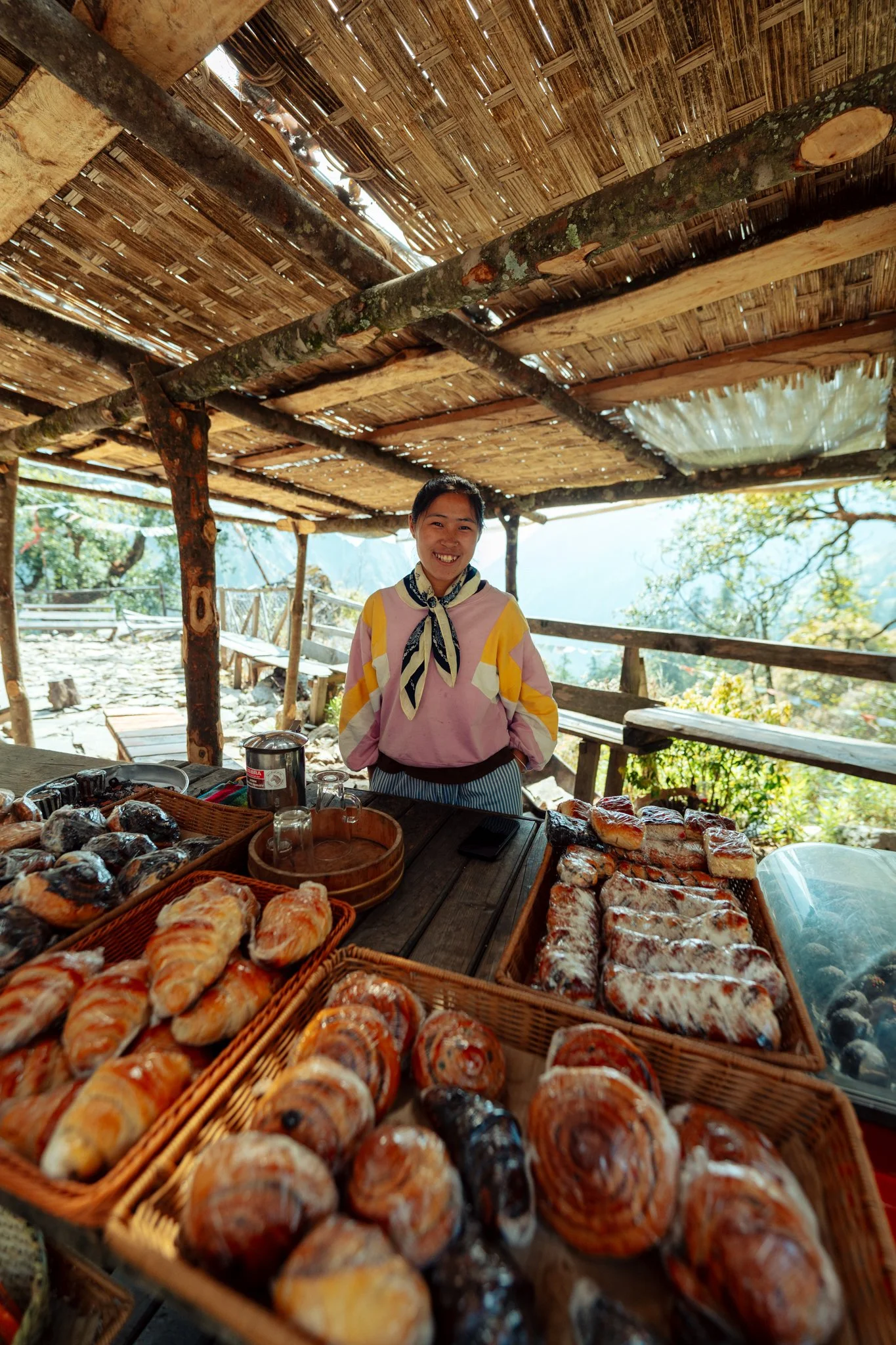
Jiwan and Das pre-packed an absurd quantity of fruit for the entire trek. Every single morning, they would peel an apple, slice it, fan it around the edge of a plate, and place a whole de-seeded pomegranate in the middle. Other trekkers would walk by our table, see this magnificent fruit display, and audibly say, "Dang, I wish my guides did that." If you take one piece of advice from this entire post, it's this: book guides who pack fruit. Once you're at altitude and your appetite is completely gone, this fresh fruit becomes the only thing your body wants. It saved me.
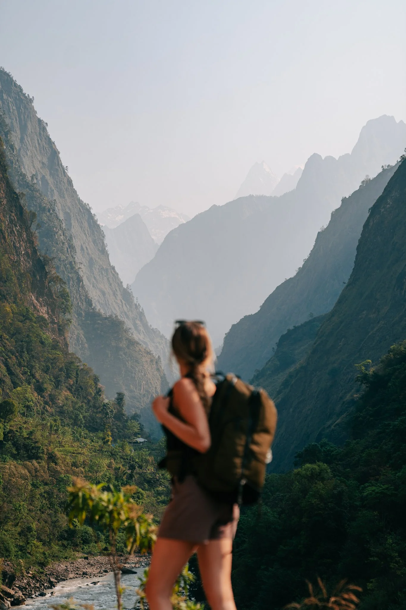
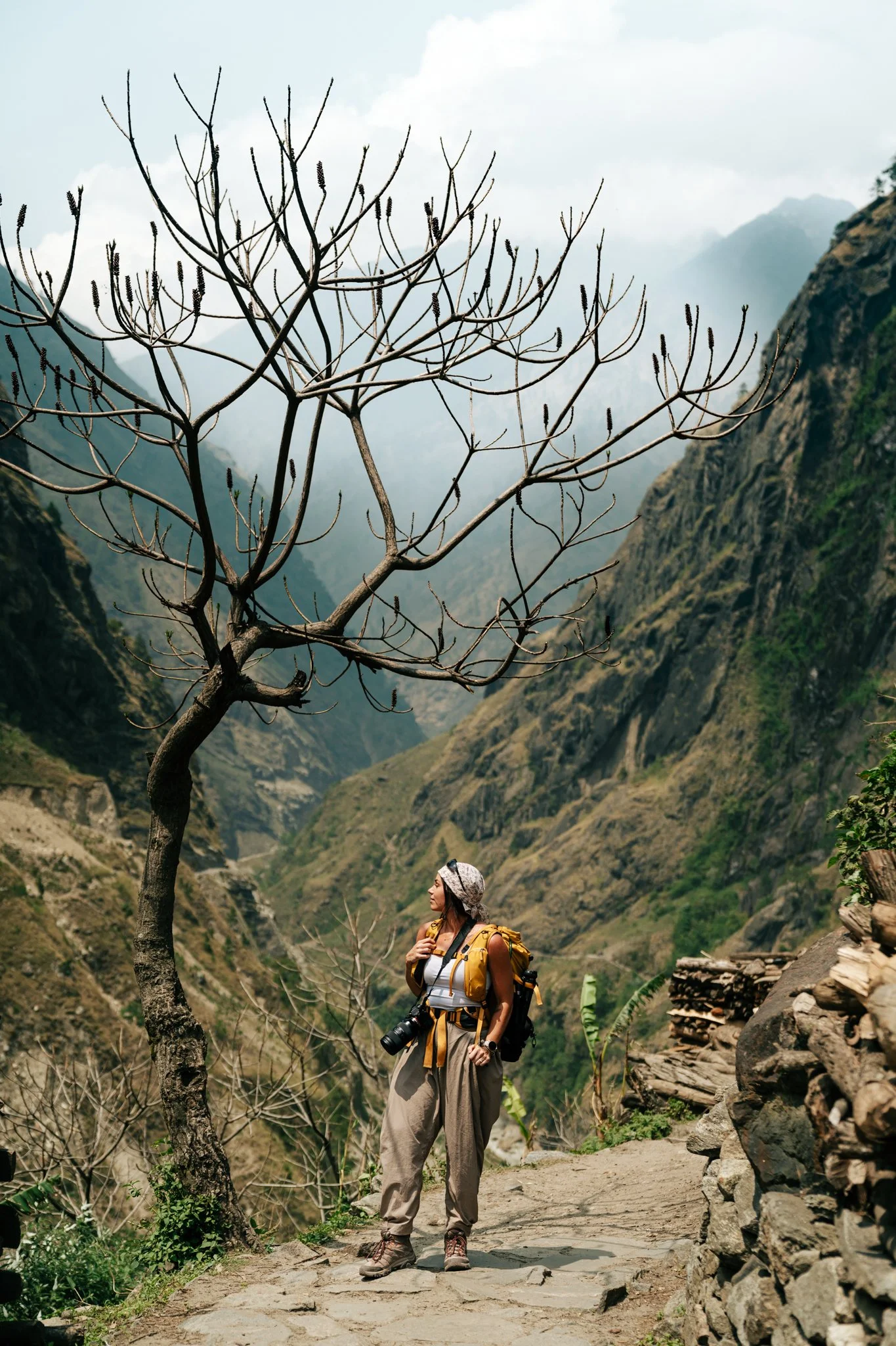
By 8 a.m. we were packed up and on the trail. Our two big backpacking bags were strapped together and carried by Das, our porter. Paige and I both carried our own personal camera bags with water, a tripod, and daily essentials. I cannot emphasize enough how important it is to have a really well-designed camera bag for a trek like this. This is the exact one I carried , and the heavier duffel-style backpacking bag is the one Das ported.
I started this trek on April 25, 2026, which I'd recommend as the most optimal window. Spring flowers are in bloom in the lower valleys, there's still snow on the peaks, the lower valleys aren't yet too hot, and the higher elevations aren't yet too cold. Late April through mid-May, or late September through early November, is when you want to go.
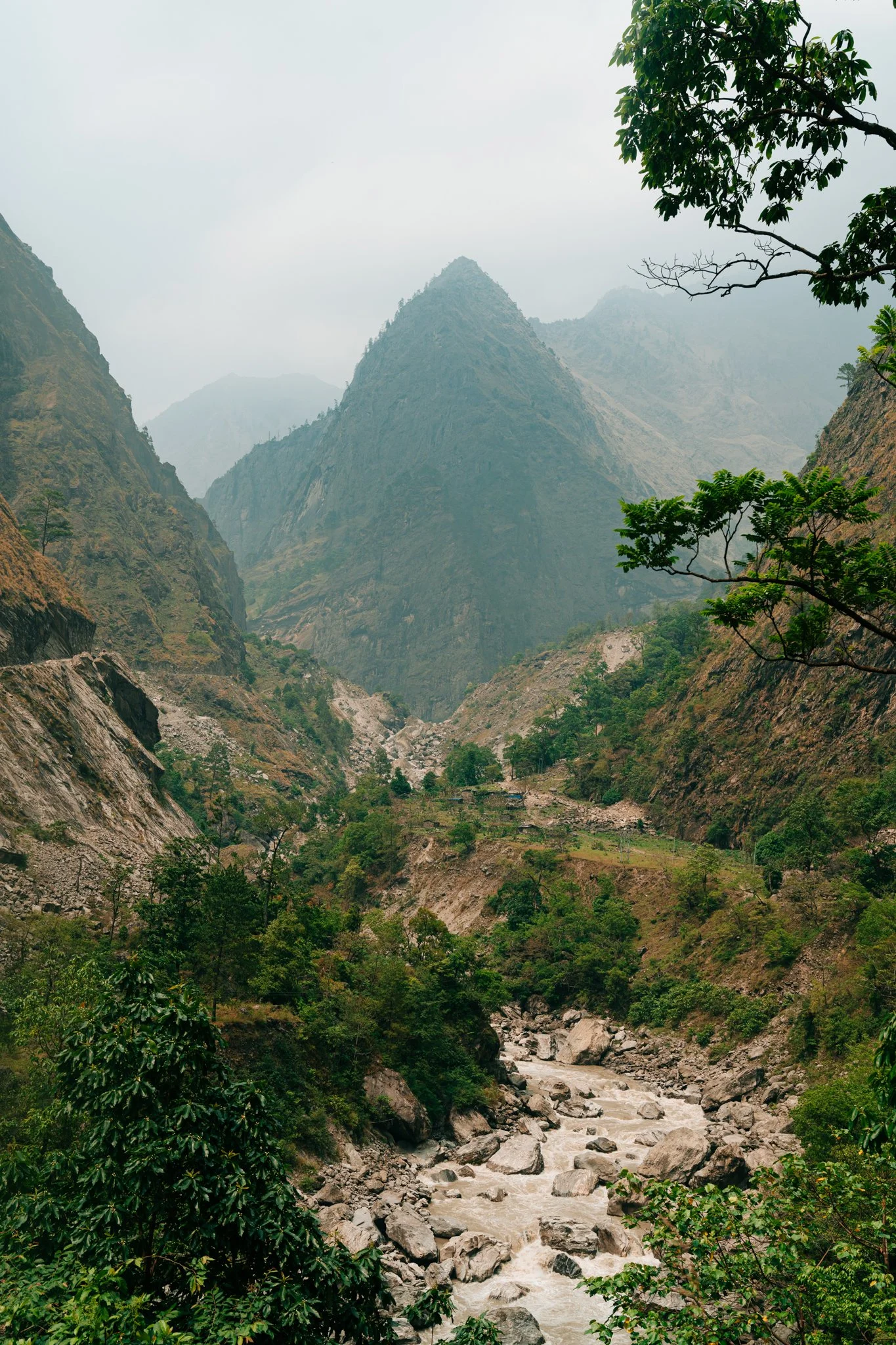
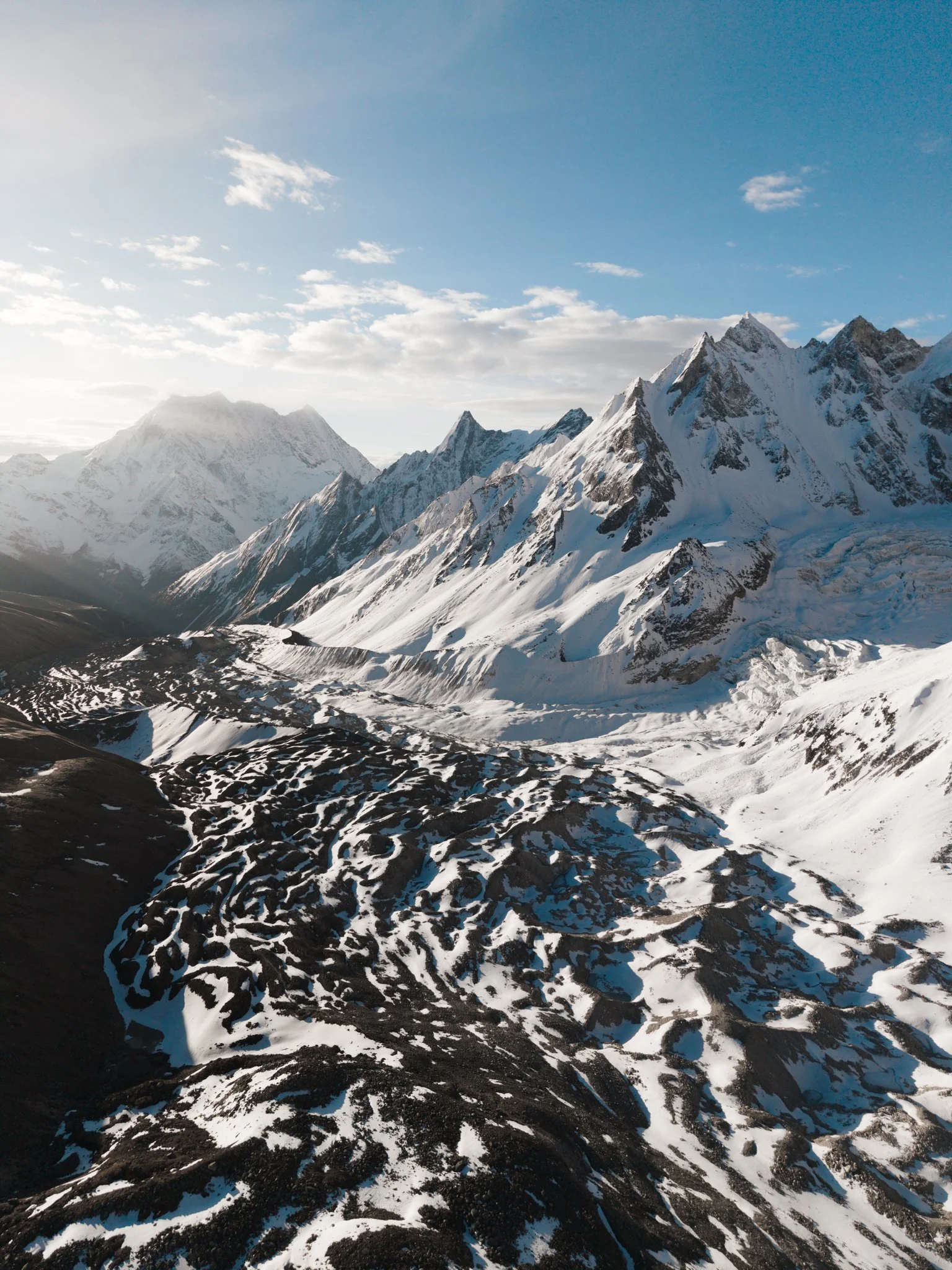
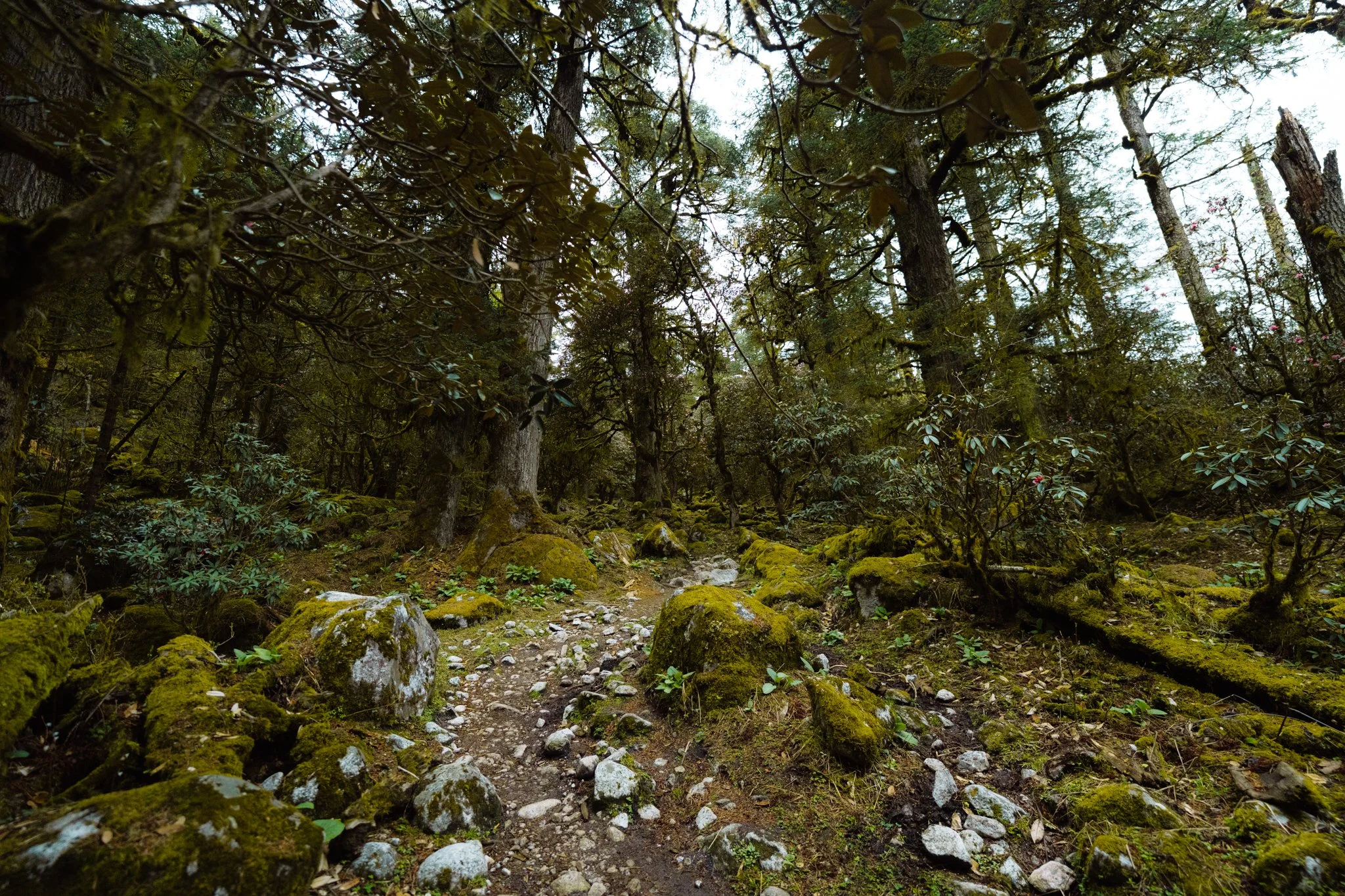
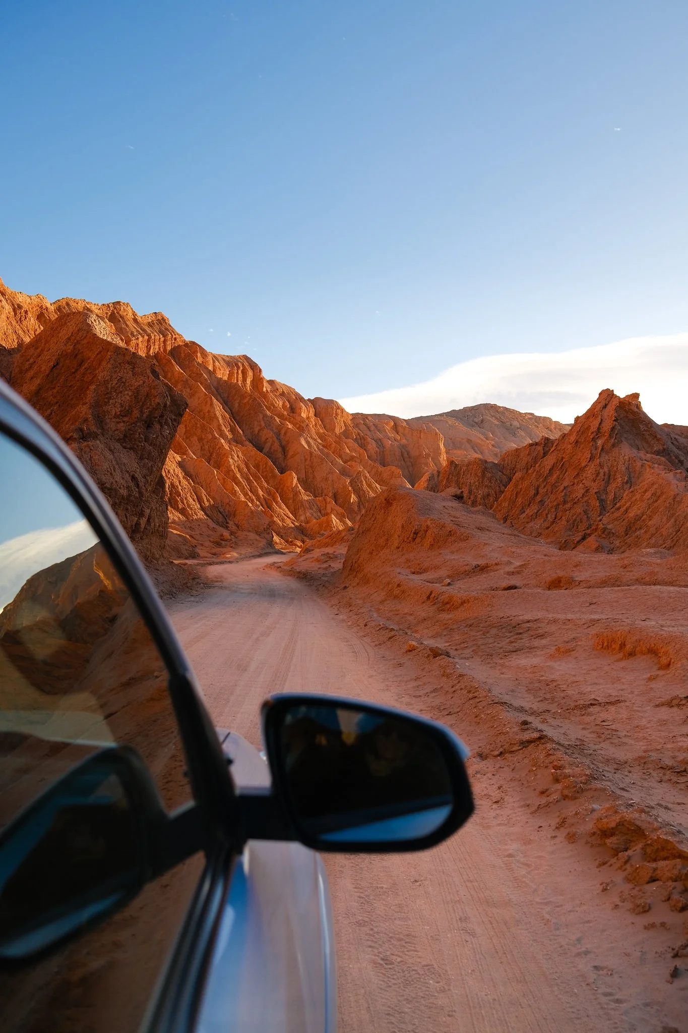
The Budhi Gandaki Gorge
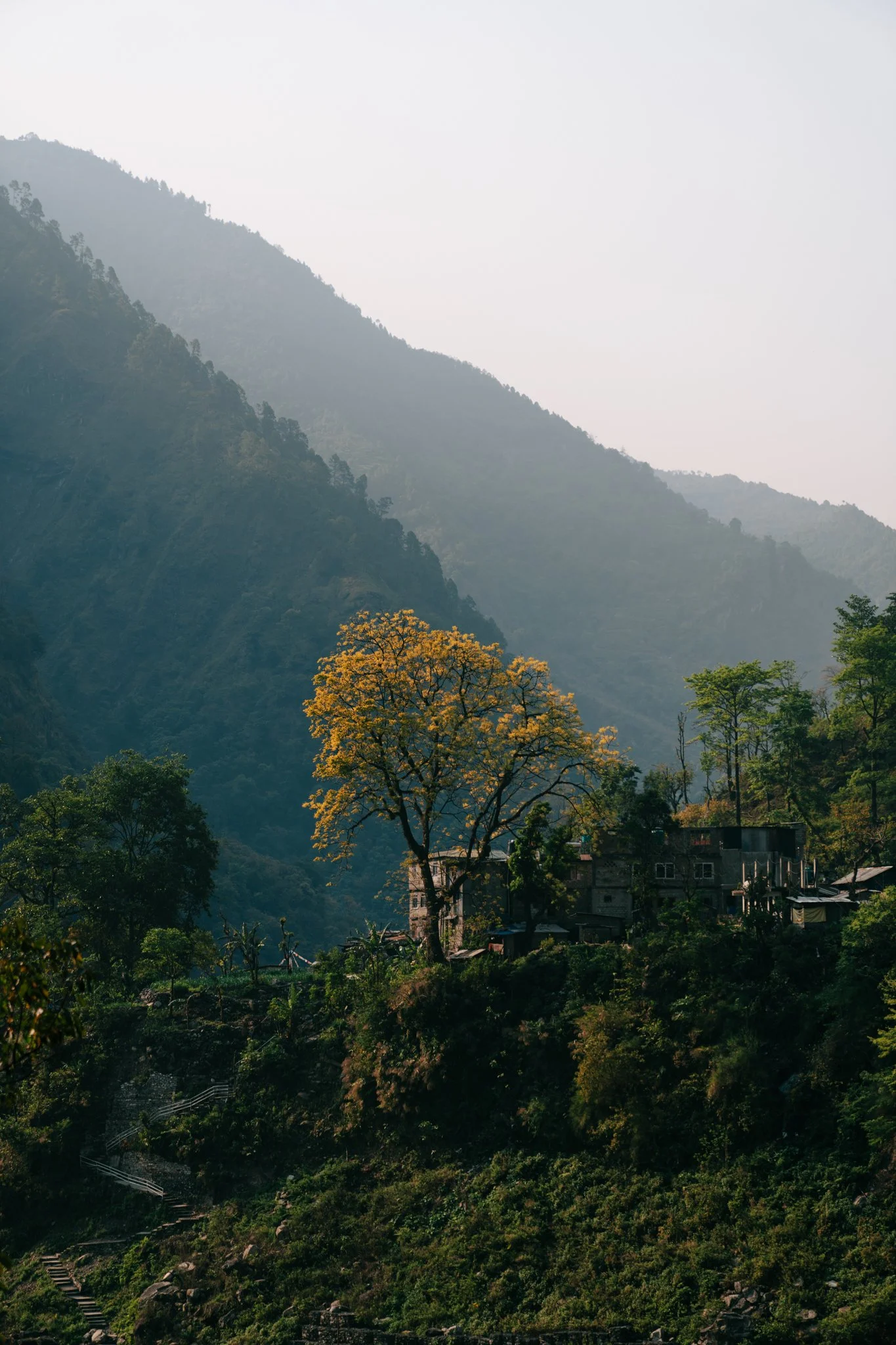
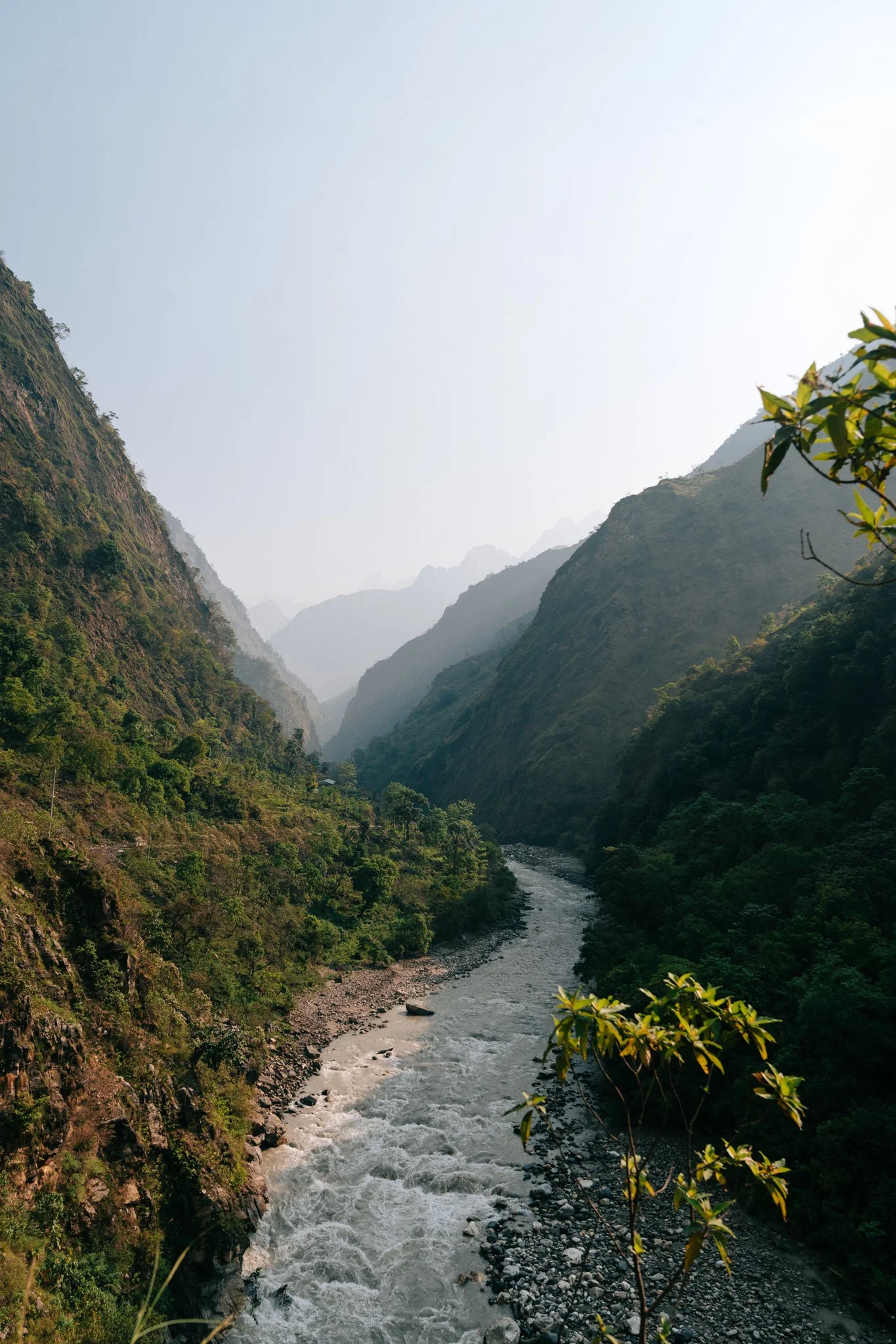
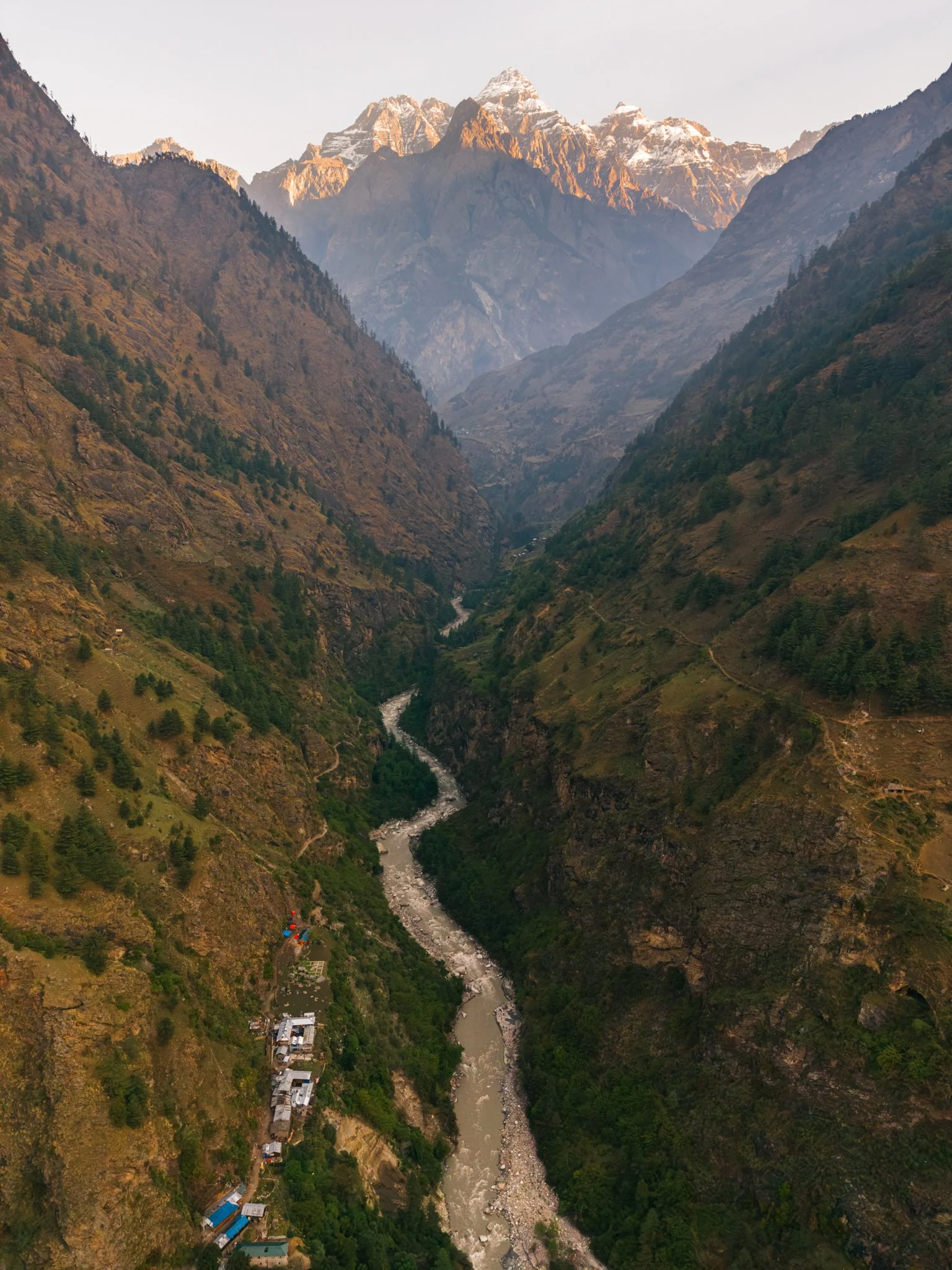
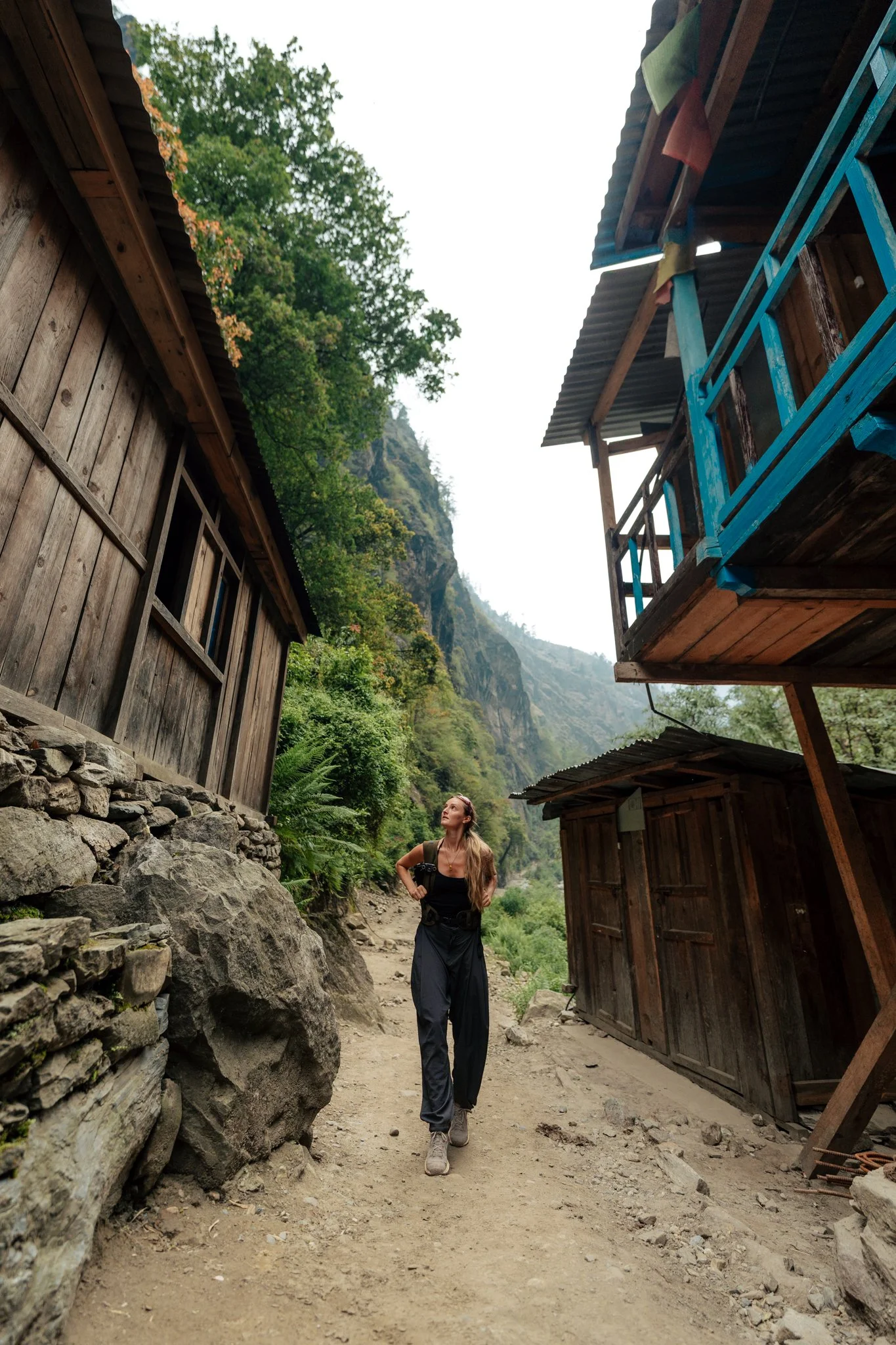
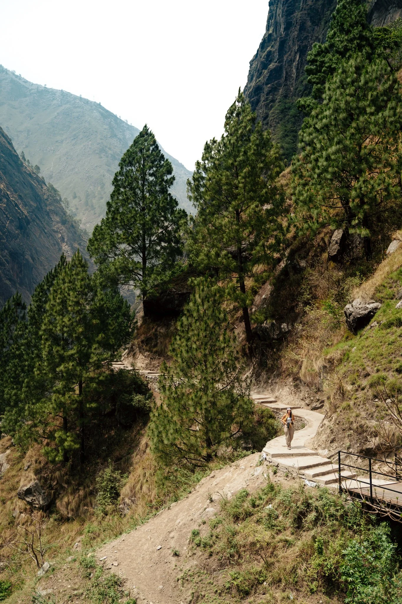
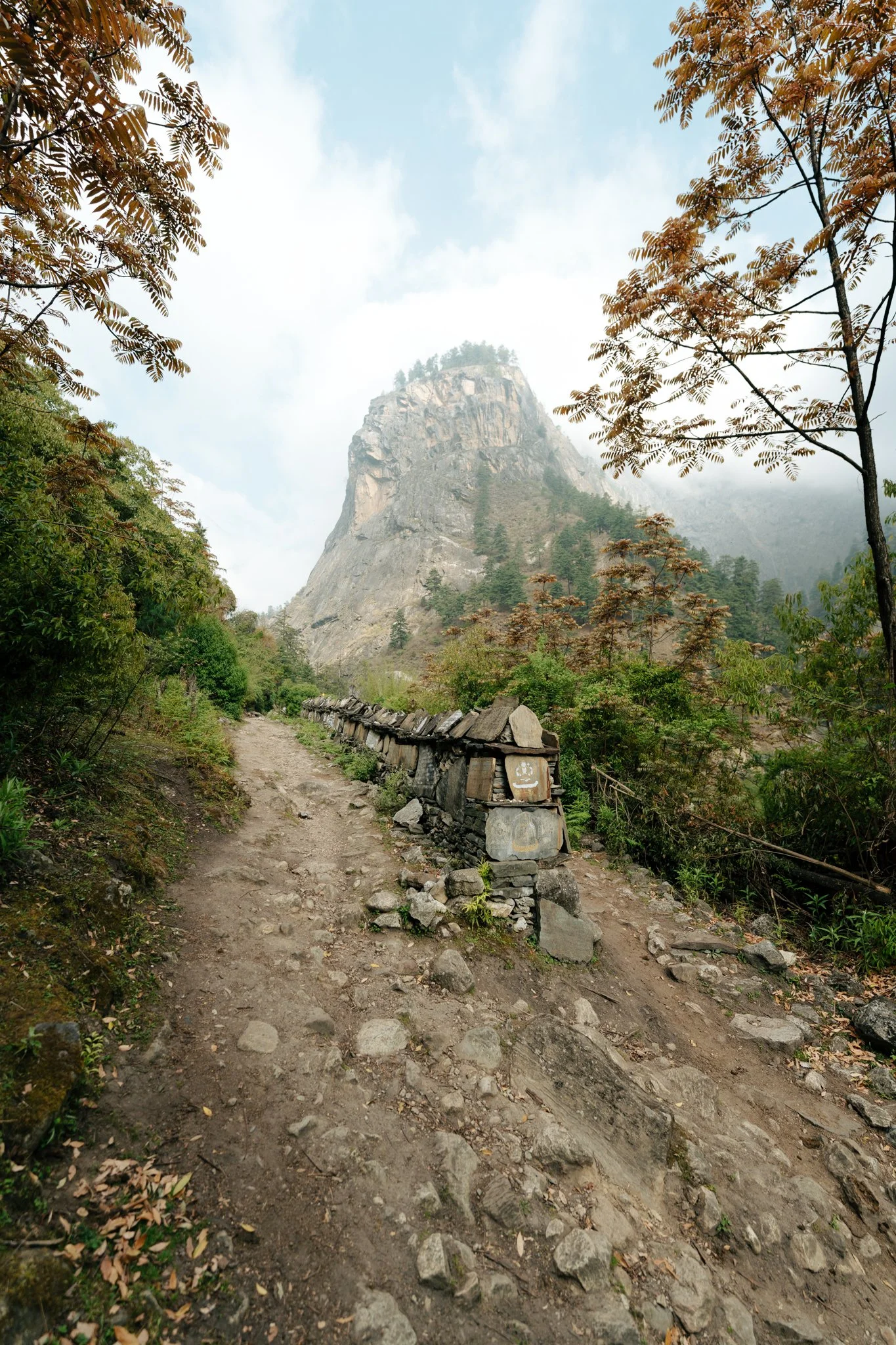
The first thing you notice walking out of Machha Khola is that you are inside a river gorge so dramatic it doesn't feel real. The Budhi Gandaki river runs along this part of the trek and becomes your guide for the first several days. Suspension bridges, waterfalls, narrow canyon walls, terraced fields cut into the cliffsides. Every bridge, every waterfall, every mountain view feels like the set of a movie. It's funny, by day three or four, you stop stopping to photograph every bridge, because you've already crossed twenty. But on day one, you are captivated.
The trek is also evolving fast. Jiwan kept telling me, "Oh, we used to have to hike down to the river and back up here, but now they built this bridge." Construction is racing to keep up with growing tourism, about 30,000 people a year do Everest Base Camp, but only around 7,000 do this trek, and as more people discover Manaslu, infrastructure is improving fast. The flip side is that landslides are still very real. We took multiple detours around recent slides during the trek. At a teahouse later in the trip, another group told me they'd hiked over a slide a few days earlier with bodies still trapped underneath, the rescue had been called off because the terrain was too unstable. This landscape is no joke.
Sunset from above Jagat. The first time the real high peaks revealed themselves.
Tatopani Hot Springs
A few miles in we passed through Tatopani, a small village famous for natural hot springs that come out of the ground so hot they have to mix the water with cold river water before anyone can sit in it. This is where Jiwan handed me my first local Nepali banana, small, ripe, sweet, with a creamy-tangy flavor and tiny seeds inside. They became my favorite snack of the trek.
This stretch of trail still allows the occasional jeep or Toyota 4Runner, local people, the occasional tour group. It's mildly terrifying watching them inch around the cliff edges while you're on foot.
Lunch and the Dog We Should Not Have Petted
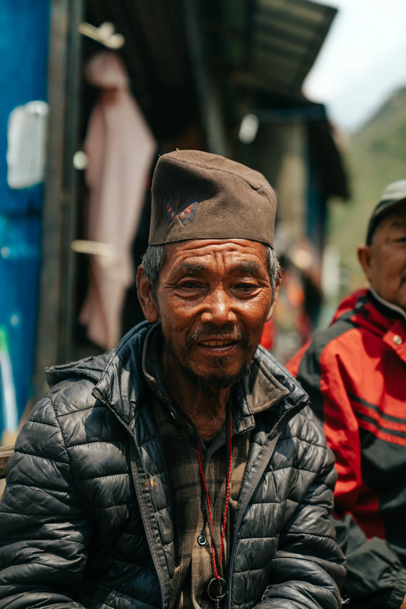
We stopped for lunch in a beautiful village and met our first group of fellow trekkers, a big group of young Israelis. I learned over the course of the trek that for many young Israelis, doing some kind of trek in Nepal is essentially a rite of passage after military service. We met Israeli trekkers all along the route. Aside from them, I met tons of Australians and Brits, and only a tiny handful of Americans. If you're an American, you'll be the unusual one, which I weirdly enjoyed.
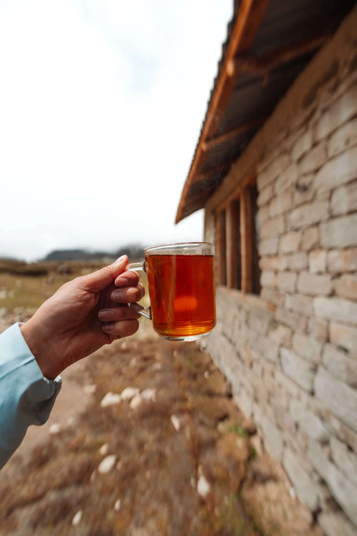
For lunch I had dal bhat, the staple food of this region. If you've never had it, dal bhat is a soupy bowl of seasoned lentils (usually green) served alongside a big plate of white rice, with various accompaniments, stewed potatoes, vegetables, pickled veggies, spicy condiments. The fancier the kitchen, the more side dishes. The simplest version is just lentils, rice, and a pickle. You will eat dal bhat so much on this trek. You will start to crave it.
Black tea or mint tea is available at almost every meal and every stop. I started getting nervous early on about where the milk in my coffee was coming from, until Jiwan told me at the end of the trek that it's all powdered milk. Honestly? I'd rather have powdered milk than unpasteurized local milk in a village with no refrigeration, so I was relieved.
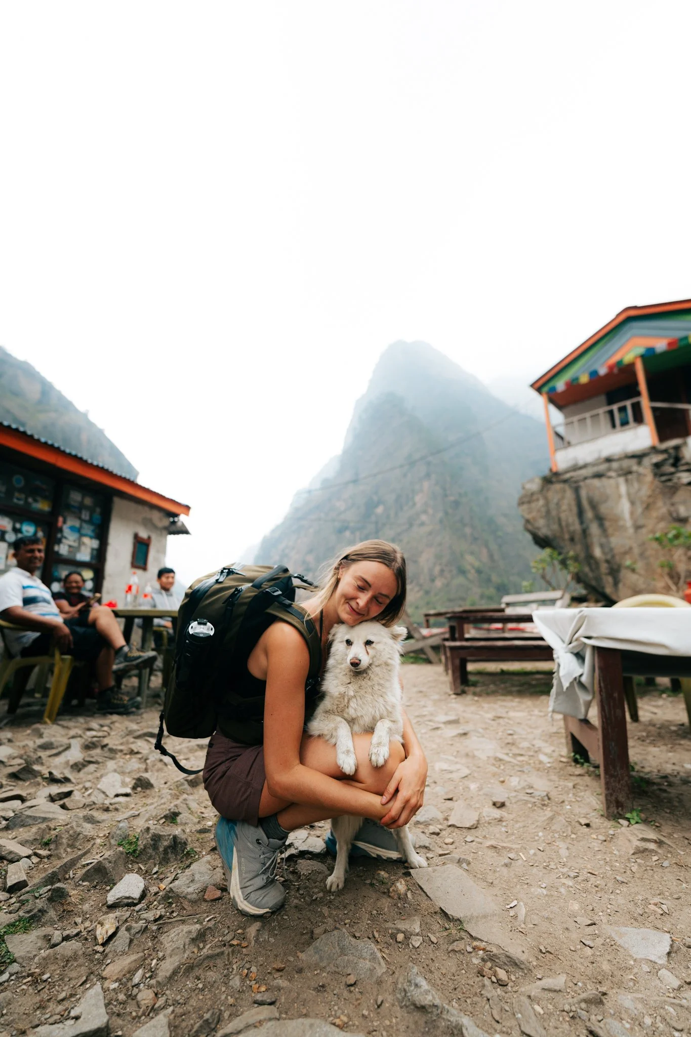
It was also at this lunch stop that the dogs of the trail first showed up. There was a sweet fluffy white one who came right up to me, and of course I sat down and hugged it like a person who has never been told not to. Jiwan had said something on the bus the day before, "Animals here are dirty, we don't really keep dogs as pets, they can have diseases," but it had blown right past me. I think Paige and I both spent that first day petting every dog we saw. This is foreshadowing.
The Sky Bridge to Jagat
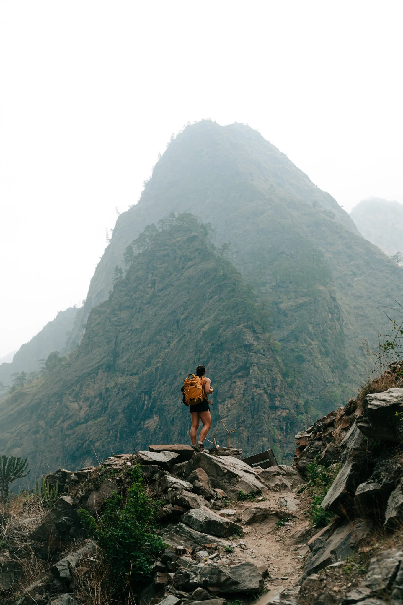
Late in the day we hit a section of trail with absolutely spectacular pointed peaks. Of course, when I asked Jiwan about them, he said, "Oh, those? Those aren't mountains. Those are hills. They don't even have names." I would learn over the course of this trek that any peak under about 7,000 meters is, to a Nepali guide, basically a hill.
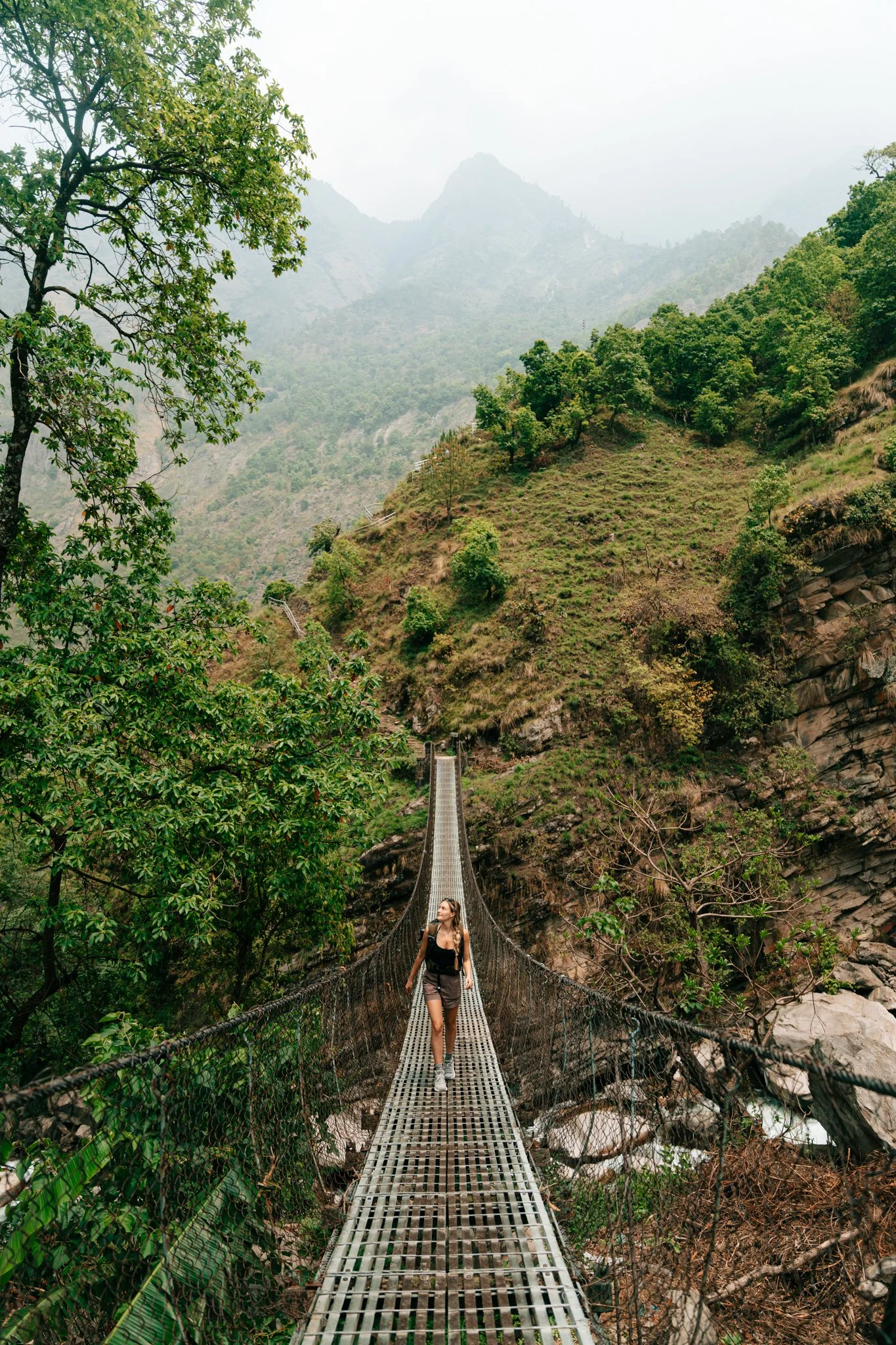
The final approach to Jagat included an optional steel walkway bolted along the side of a mountain. The other option was to walk down along the riverbed instead, which is what most people do, but Paige and I were ambitious and wanted the elevated sky-bridge experience. We climbed up onto it and quickly understood why most people don't take it. Rockslides had taken out portions of the walkway. There were random missing grates and holes you could fall through. We made it across, but I would not necessarily recommend this route unless you're feeling brave.
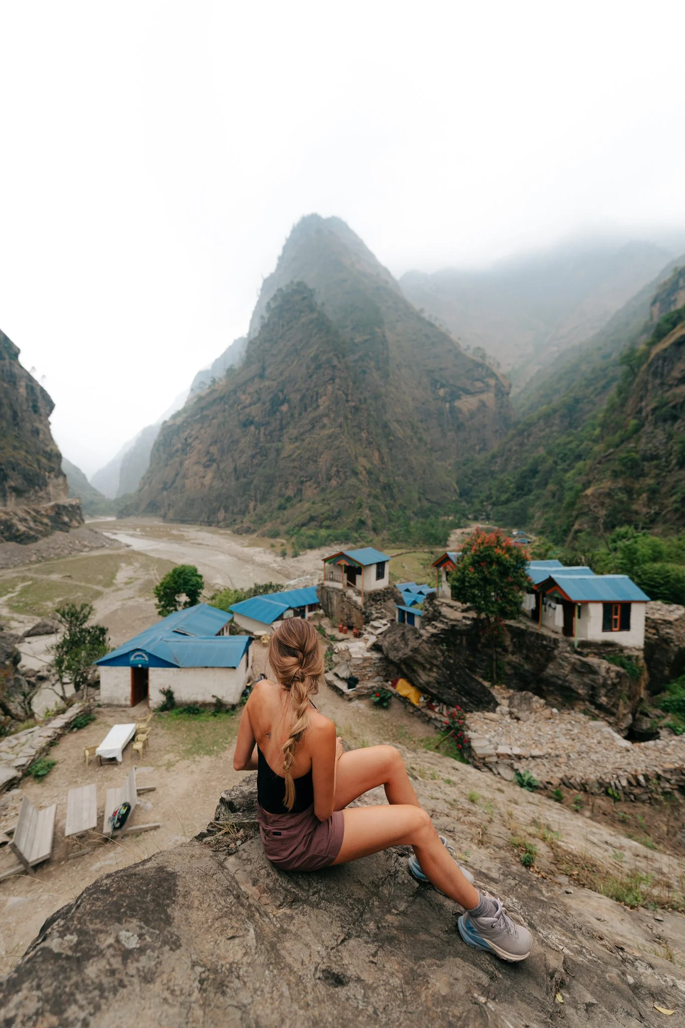
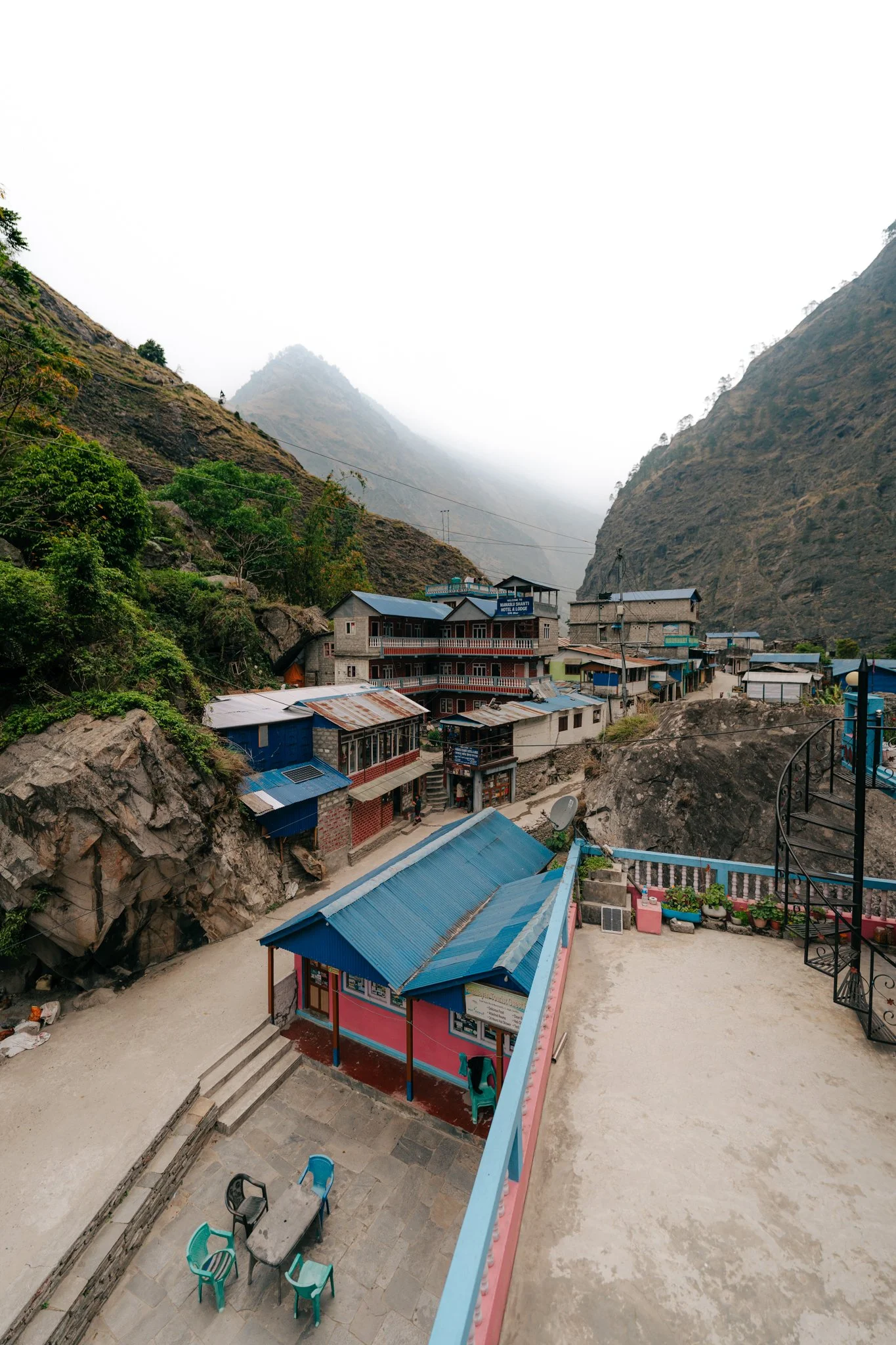
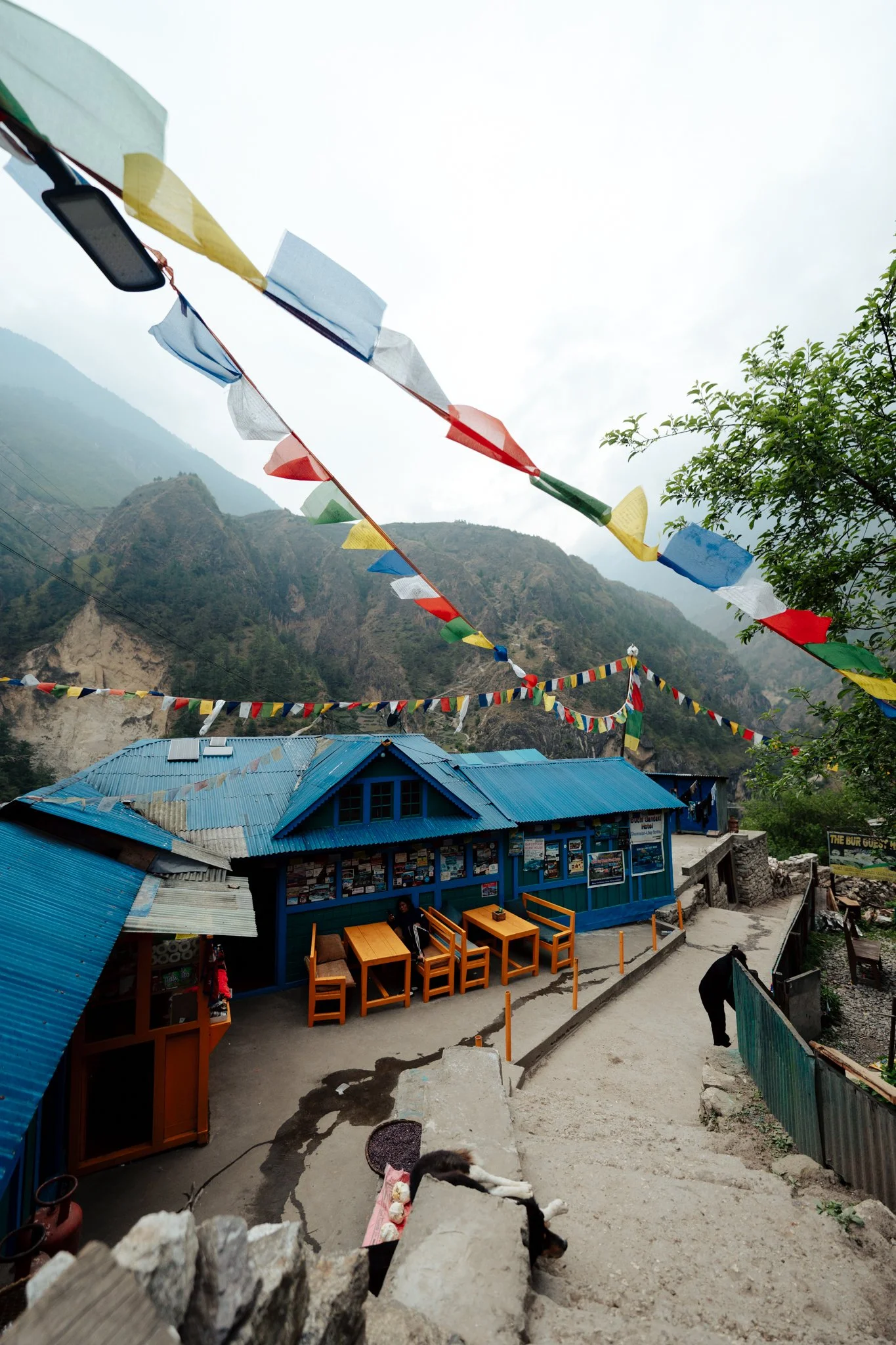
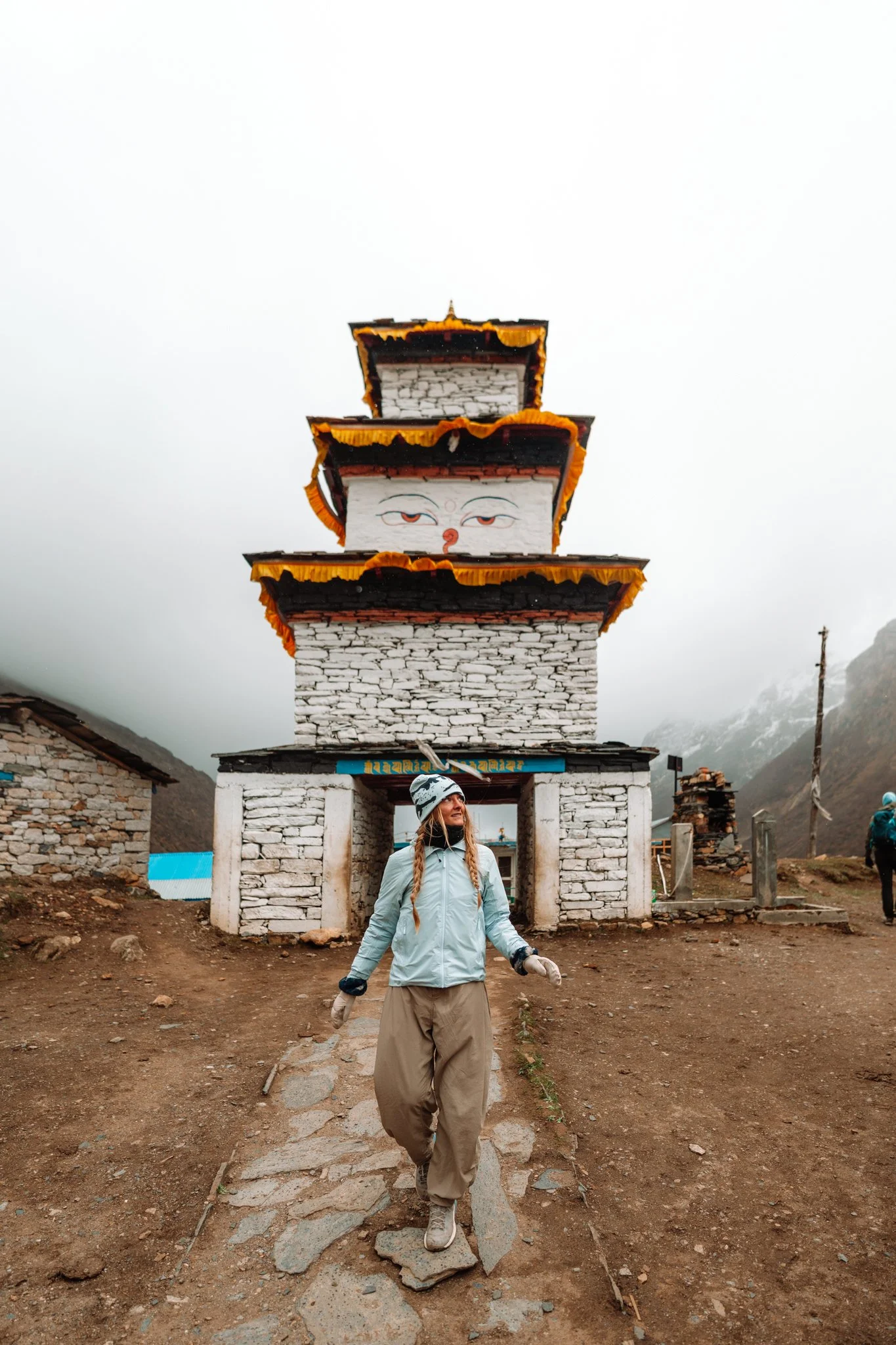
We arrived in Jagat ten miles in. The town is the most charming pink-and-blue village, pink stucco buildings with blue corrugated roofs, tucked into the valley with a monastery you can climb up to via side stairs. I had egg fried rice, Paige had curry, and we stayed up chatting with the trekkers who'd been on our chaos bus the day before. Bed was glorious.
DAY 2: Jagat → Deng (12 miles, 22 cumulative)
The Waterfall I Wish We'd Found Sooner
Up at 5 a.m. Brushed my hair in a mirror that was outside our room. We had an in-room bathroom, which felt like a luxury. Took a warm shower. Breakfast was a Tibetan-style pancake with honey, plus the daily fruit plate.
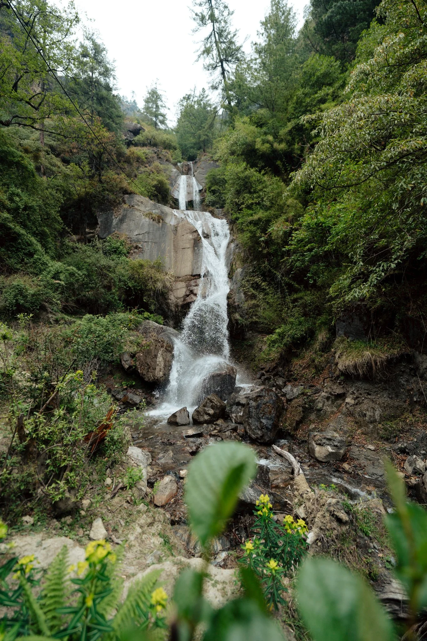
Just outside Jagat is a series of waterfalls so beautiful I genuinely gasped. The rocks are dark gray and slightly slippery, and the water is bright blue, a striking contrast against the murky Budhi Gandaki we'd been following. Other trekkers actually swim here. If we'd known about it the night before, after a hot sweaty day one, I absolutely would have. There's a suspension bridge that crosses over a little cove of waterfalls, and Paige and I spent way too long shooting photos and videos. Just gorgeous.

The Jagat waterfalls, just outside the village. Worth backtracking for, if you missed them on Day 1.
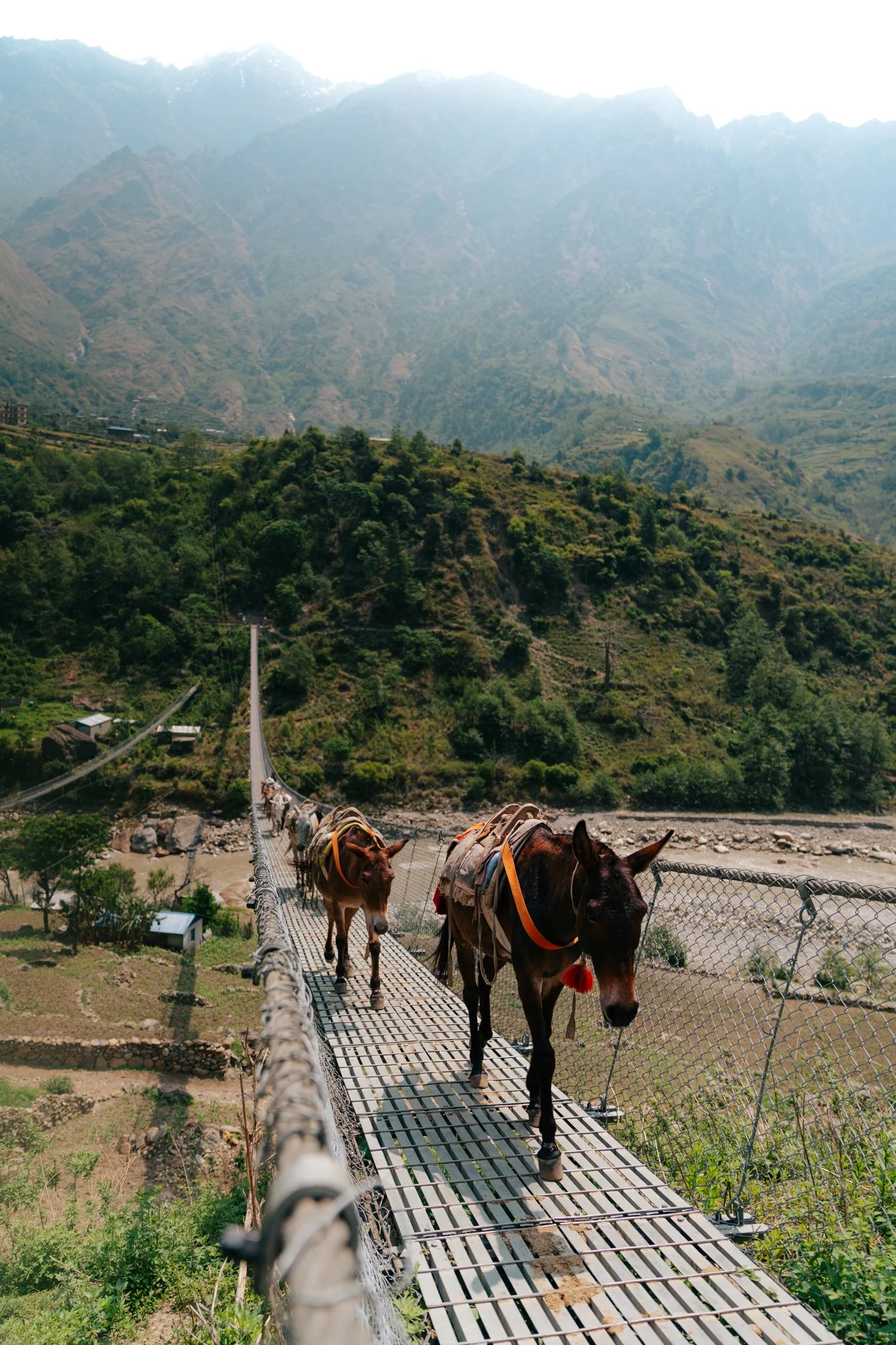
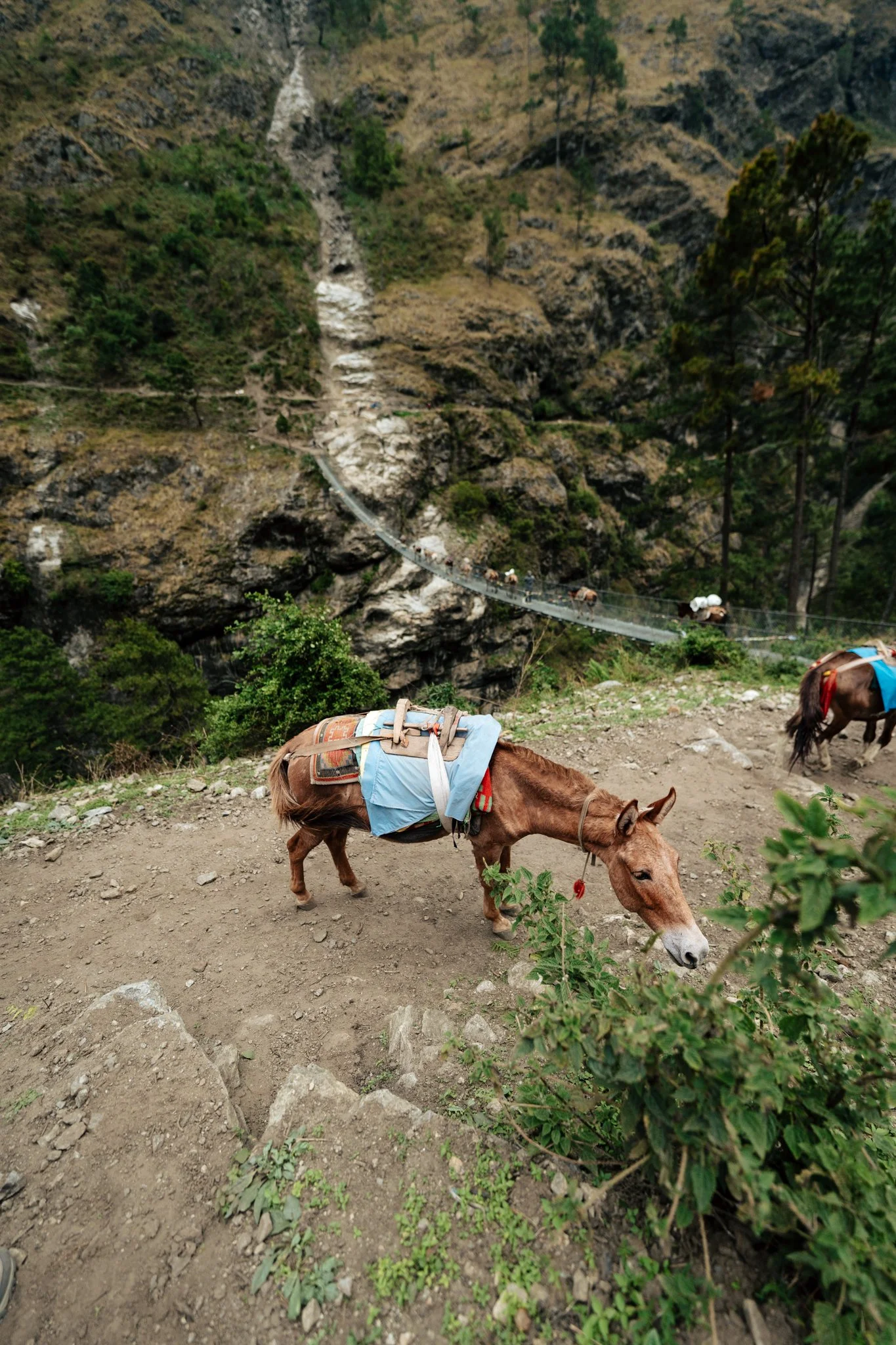
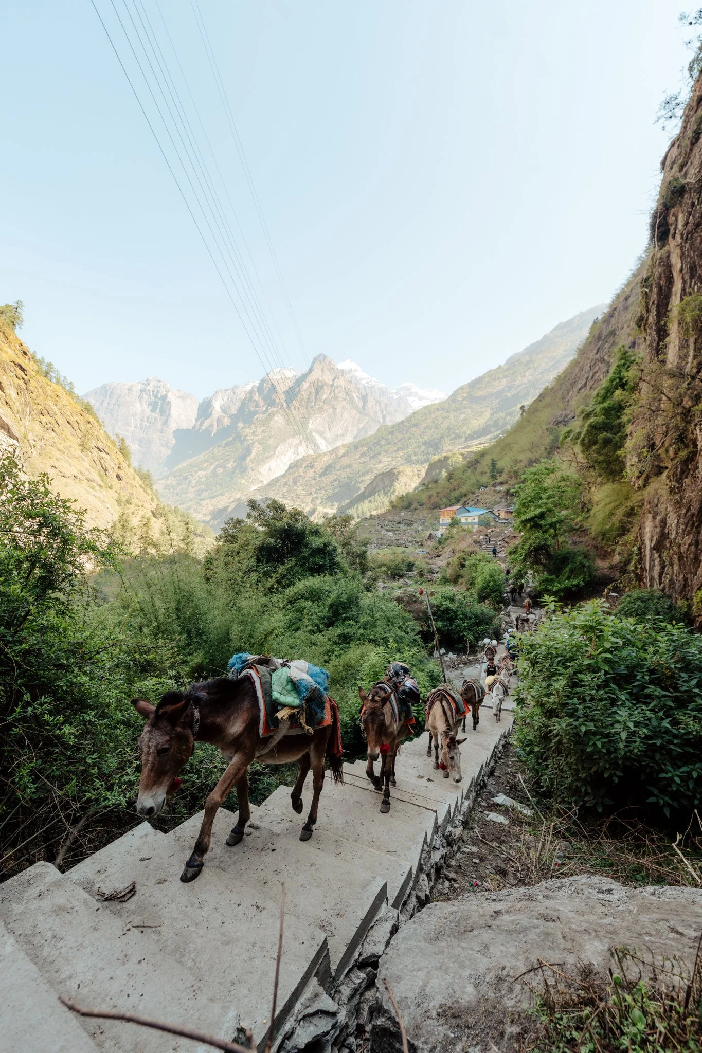
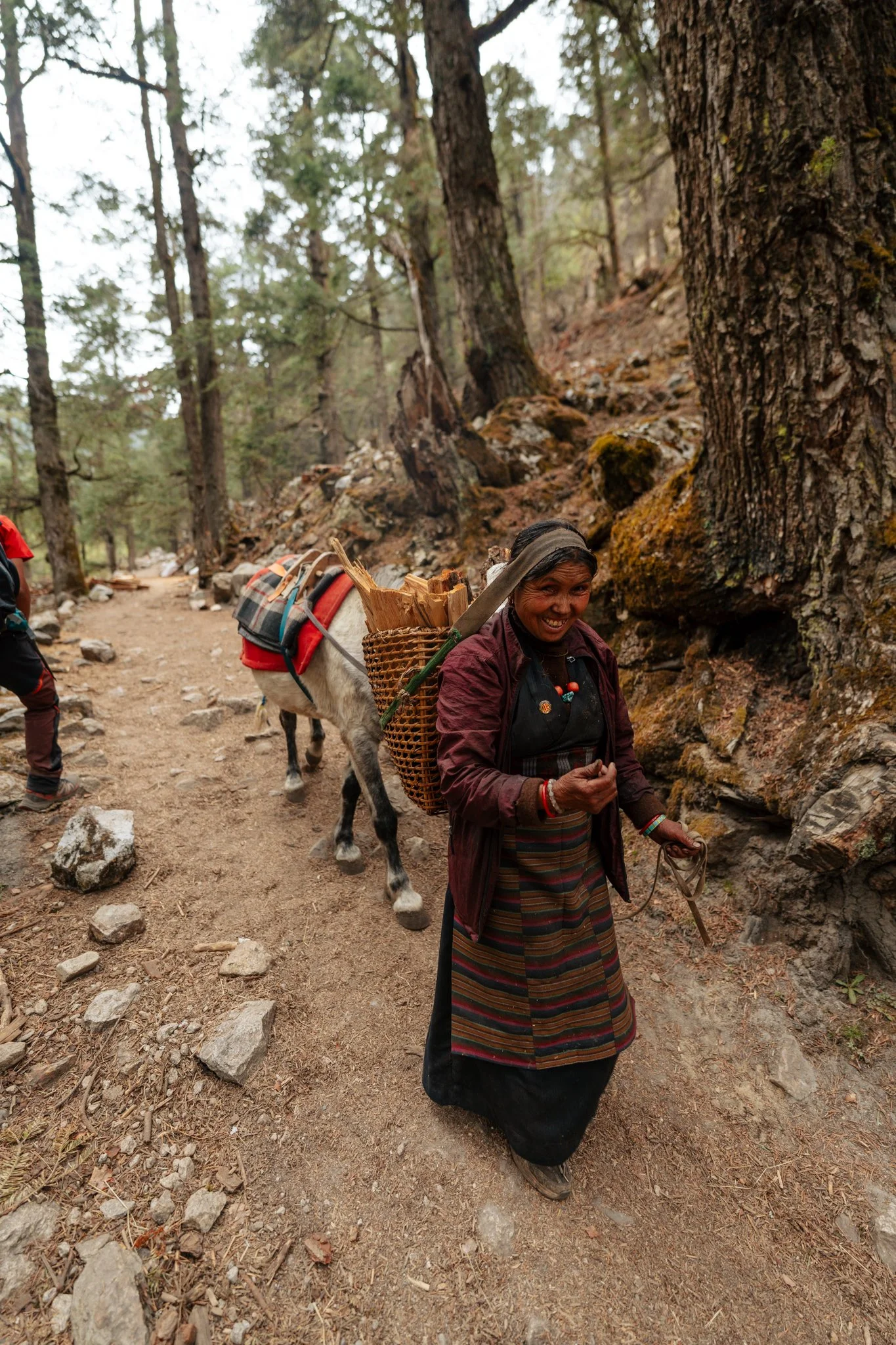
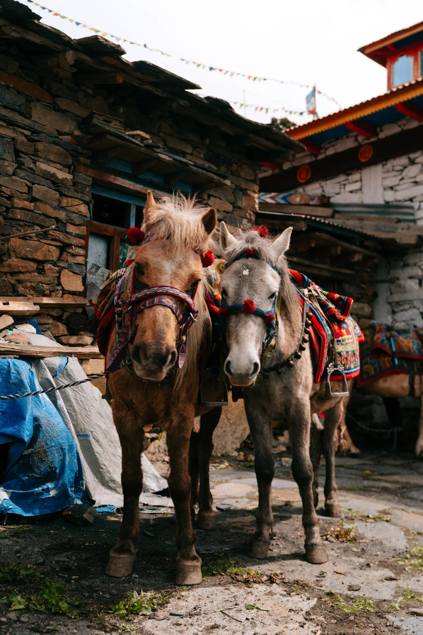
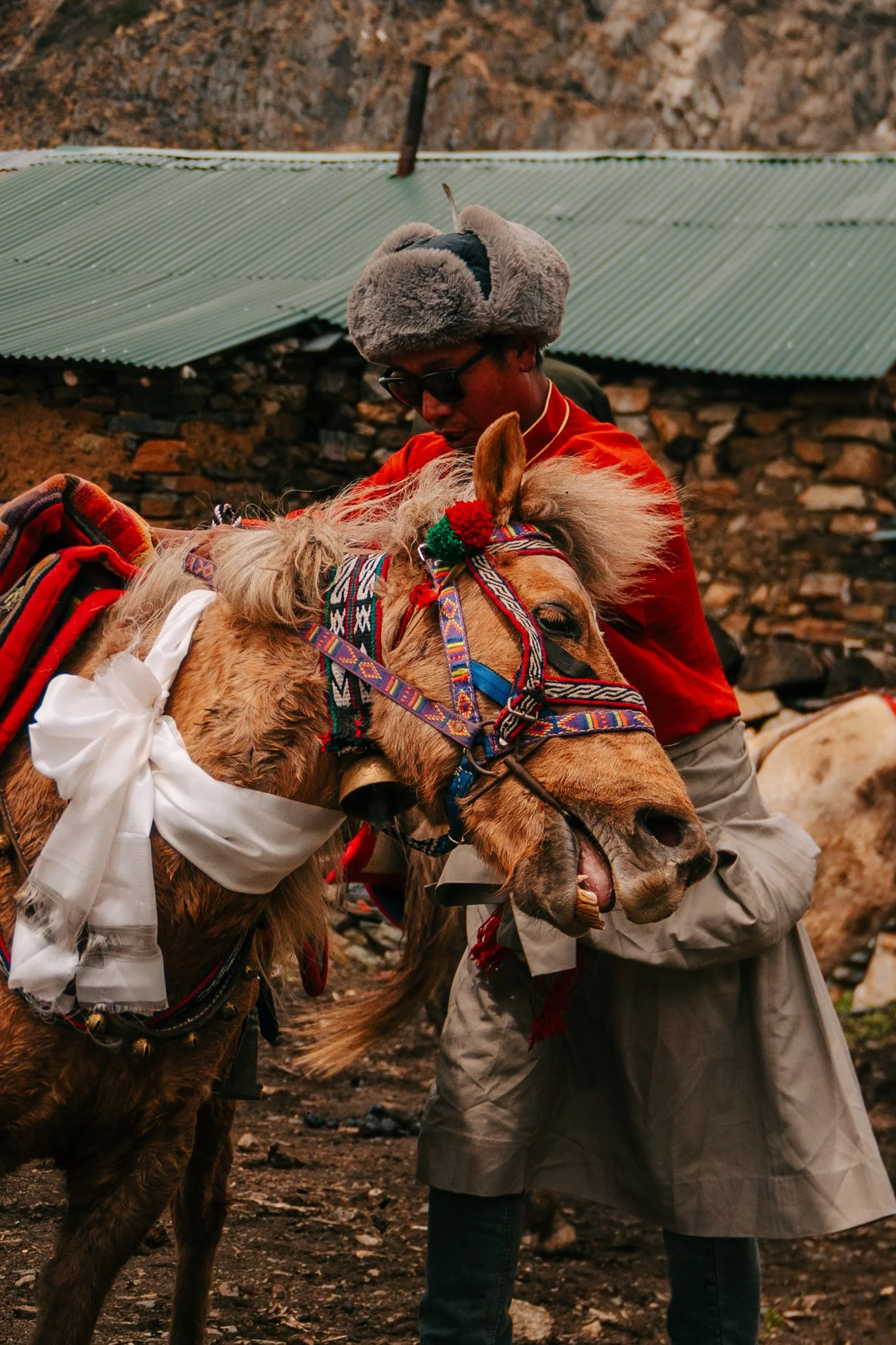
The Mules
This stretch of trail is where you start meeting the mules, endless caravans of them carrying grain, fuel, supplies, anything that needs to move between villages. Paige and I had long, deep conversations about animal welfare watching these animals work. As an eleven-year vegetarian, I think about animal welfare constantly, it's the foundation of why I don't eat meat. But up here, you confront something real: without these mules, the people in these villages cannot live. They cannot get fuel, they cannot get rice, they cannot feed their families.
What a privilege it is to care so much about animal welfare in the way I do at home. What a privilege to not need a mule to carry my groceries up a mountain. Humans have used animals like this for thousands of years in environments like this. I'm not condoning anything, I just felt humbled in a way I wasn't expecting. This trek has a way of making you sit with your own contradictions.
Philim — The Last Real Town
We crossed a bunch of bridges, hiked some serious mountain passes, and made it to Philim, which Jiwan told me is the biggest town in this section of the trail. It had a coffee/bakery shop, I genuinely don't think I saw another one of those for the rest of the trek. There was a main street with shops and small hotels, which also became increasingly rare after this point.
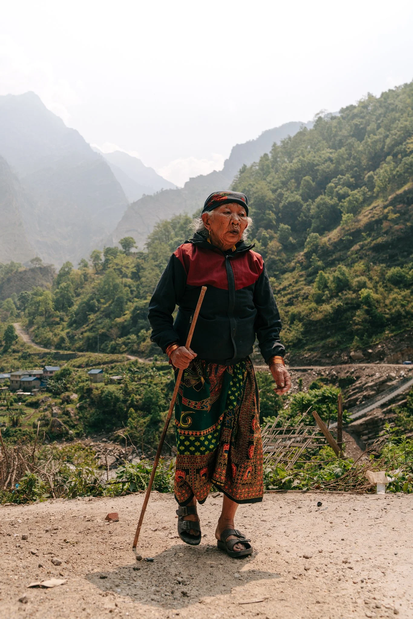
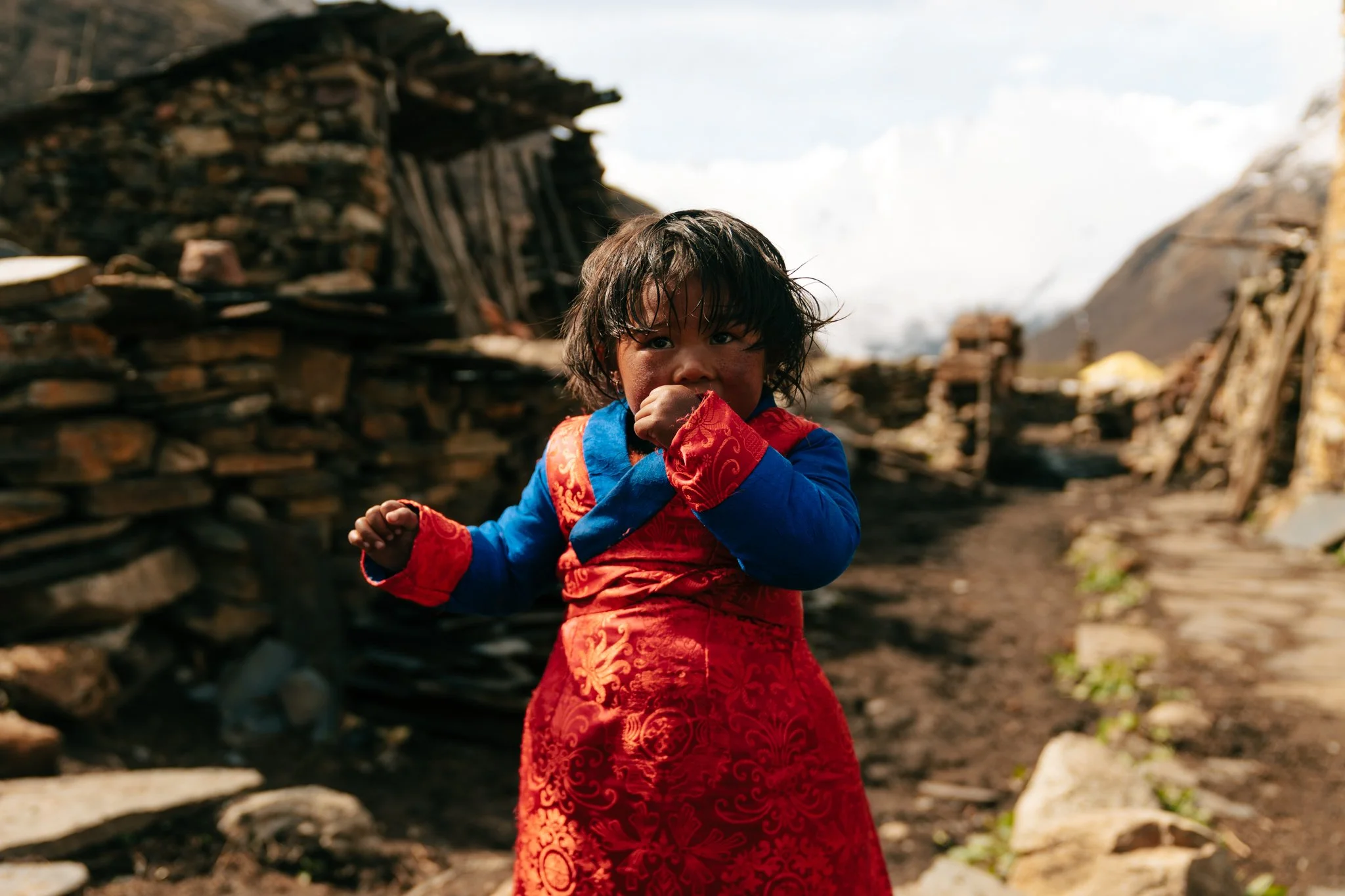
This is where I had my first real interaction with elderly villagers. A small group of older women came up curious about my camera and what we were photographing. They were so kind. Important note for photographers: if you want to take portraits of local people, sometimes they'll ask for a tip. This honestly makes total sense to me, you're using their likeness, they're getting nothing else from it, why wouldn't you compensate them? Bring extra small cash for this. I didn't have any on me, so I shared a handful of Swedish Fish from my snack bag, and they were genuinely happy. Shoving a camera in someone's face is awkward at the best of times, and being able to give back something, even candy, turns an extractive moment into a generous one.
Lunch Above the Valley at Chisapani
Most people stop in Philim for lunch, but we pushed through to the next village, I think it was called Chisapani based on the name of the hotel we ate at (Buddha Hotel Ekle Bhatti Chisapani). We had lunch with a sweeping view over the valley. We both ordered rösti, which if you've been to Switzerland, is a smashed and pan-fried potato patty, crispy at the edges. They served it with ketchup and a green sauce on top. Genuinely good lunch.
The Mules and the Bridge — Timing Matters
Past Chisapani is where the trail turns properly mountainous. The valley narrows. The bridges get higher. We crossed some of the tallest suspension bridges I've ever been on.
This is also where we learned a new rule of trail etiquette: if you're crossing a long suspension bridge and you can see a mule pack coming the other way, you either wait or you run. Mules cannot turn around or yield. You will get stuck against the railing if they catch you in the middle. Paige and I crossed one bridge fine, but Das was about five minutes behind us with the heavy bag, and the mules were already approaching. He sprinted across with his enormous load with seconds to spare. It looked like something out of a movie.
The Day I Broke My Camera
And then, just past Philim, I had the single most devastating gear moment of my entire creative career.
I keep my Sony A7IV on a Peak Design Capture Clip mounted to my backpack strap. It's the best piece of gear I've ever owned, fast, secure, lets me draw the camera and shoot in seconds. The clip has gotten a bit older. I always make sure I'm holding the bottom of the camera until I hear the lock click.
This time, I heard the click. I took my hand off the bottom. I pushed down to confirm it was seated.
It wasn't seated. The camera shot straight to the rocky ground, full force.
The LCD screen shattered completely. The lens, my Sony 24-70 G Master, the lens I've owned for five or six years and used for everything, was knocked clean off the body. If you know G Masters, you know they're the kind of expensive that makes you sit down. I just stood there staring at it. I'm a travel photographer. The camera is my whole job.
Here's the thing about a trek like this: there's nowhere to send a broken camera for repair, and there's no time to grieve. Survival mode kicks in. I had my 14mm prime in my bag, the body still functioned, and I could still compose through the viewfinder. The LCD was gone, so I couldn't review shots, change settings visually, or even confirm focus on the back of the camera. Every single photo from day three onward was composed blind through the viewfinder, with settings I had to remember from muscle memory. I shot the rest of this trek on a broken camera with one lens and no screen. Welcome to my photography portfolio.
Arrival at Deng
22 miles in, lower morale than yesterday, the remoteness setting in for the first time. Deng turned out to be one of my favorite villages of the trip though, clean teahouses, warm staff. There was a heated propane shower in the bathroom that the staff had to come light for me. There's a propane heater box mounted right inside the shower stall with an actual flame inside, they ignite it like a gas stove and the box heats your water on demand. Holy hell, I'm not gonna lie, I felt like I was going to explode the entire time. It did not feel like water should be that close to an open flame. But it worked.
Village of Deng
Real Talk About Showering on This Trek
Here's what I wish someone had told me about teahouse showers:
Bring your own towel. They don't provide them.
Bring a small shower tote or caddy with a hook. There is nowhere to set anything down. The floors are wet, often there's a squat toilet on the same floor of the same room, and you don't want any of your things touching anything in there.
Plan to bring everything in and out. Soap, shampoo, hairbrush, towel, change of clean clothes, all of it has to come with you and leave with you.
I really love my Dagne Dover toiletry bag for keeping all of this organized. For the trek itself, I downsized hard. Here's what I actually brought:
Magnetic refillable travel bottles for shampoo and conditioner
An Everist scent-free body wash balm
These deodorizing body wipes from Amazon , absolutely essential, especially when there's no hot shower. I buy them in bulk.
Toothbrush, full-size toothpaste, and yes, deodorant (I shouldn't have to say it, but here we are)
One good face cream that doubled as hand cream
Korean SPF, milky, creamy, goes on smoothly. Nothing is more important than sunscreen at altitude. There are infamous TikToks of people who didn't wear sunscreen on a trek like this and ended up with a sunburn mustache from sun reflecting off the snow back onto their face. Do not be that person.
Bronzer, mascara, one makeup brush, only for vlog days when I had energy to look slightly less feral
Blistex medicated lip balm, old-school, works
Sleep Setup at Altitude
Every teahouse room comes with a raised bed, a thin mattress, a pillow, and a big down comforter. The bedding always seemed clean and I never once found a bug, but I am not a brave woman about anonymous bedding, so I brought a thermal sleeping bag liner and slept inside it every single night, even on the warmer nights when I didn't need a sleeping bag yet. I also wrapped my own fleece around the pillow each night. You could bring a small pillowcase instead, both work.
I cannot emphasize enough how important sleep is on this trek. The hike is so long and so hard that anything you can do to actually rest is worth the bag space. Do not feel guilty about bringing comforts from home. Everything else about this experience will be uncomfortable. Let your sleep system be the part that isn't.
Dinner at Deng was a big plate of veggie fried noodles and pumpkin soup. Mint tea here is something special, they pull a fresh sprig of mint from a plant growing nearby, wash it, and drop the entire stem into a hot mug of water. After a long hard day in the cold, it tastes like medicine. This was the night I retired my tank top and switched into a fleece for the rest of the trek.
DAY 3: Deng → Bihi → Ghap (9.8 miles, 31.8 cumulative, 8,016 ft)
This is the day everything changed.
The Morning
Up at 5:30. Blue sky and alpine glow on the peaks for the first time. Morale was higher than the night before. I switched into a sweatshirt for the cooler air. Hard-boiled eggs, black tea, fruit plate.
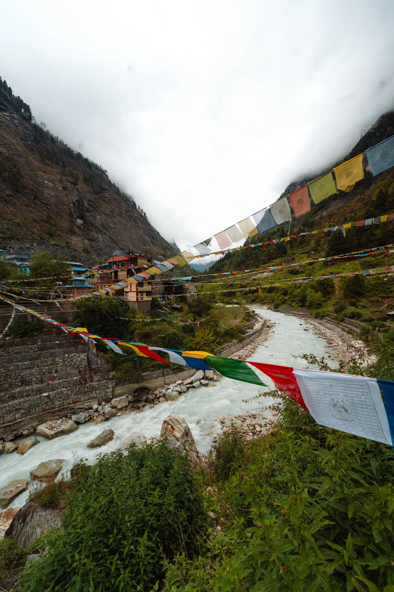
The valley is starting to feel different. Tibetan architectural influence is showing up, blue-trimmed roofs, prayer flags strung between buildings in red, white, yellow, green, and blue. We crossed a lot of bridges, climbed steadily, passed through cute little villages, and kept gaining elevation.
Bihi
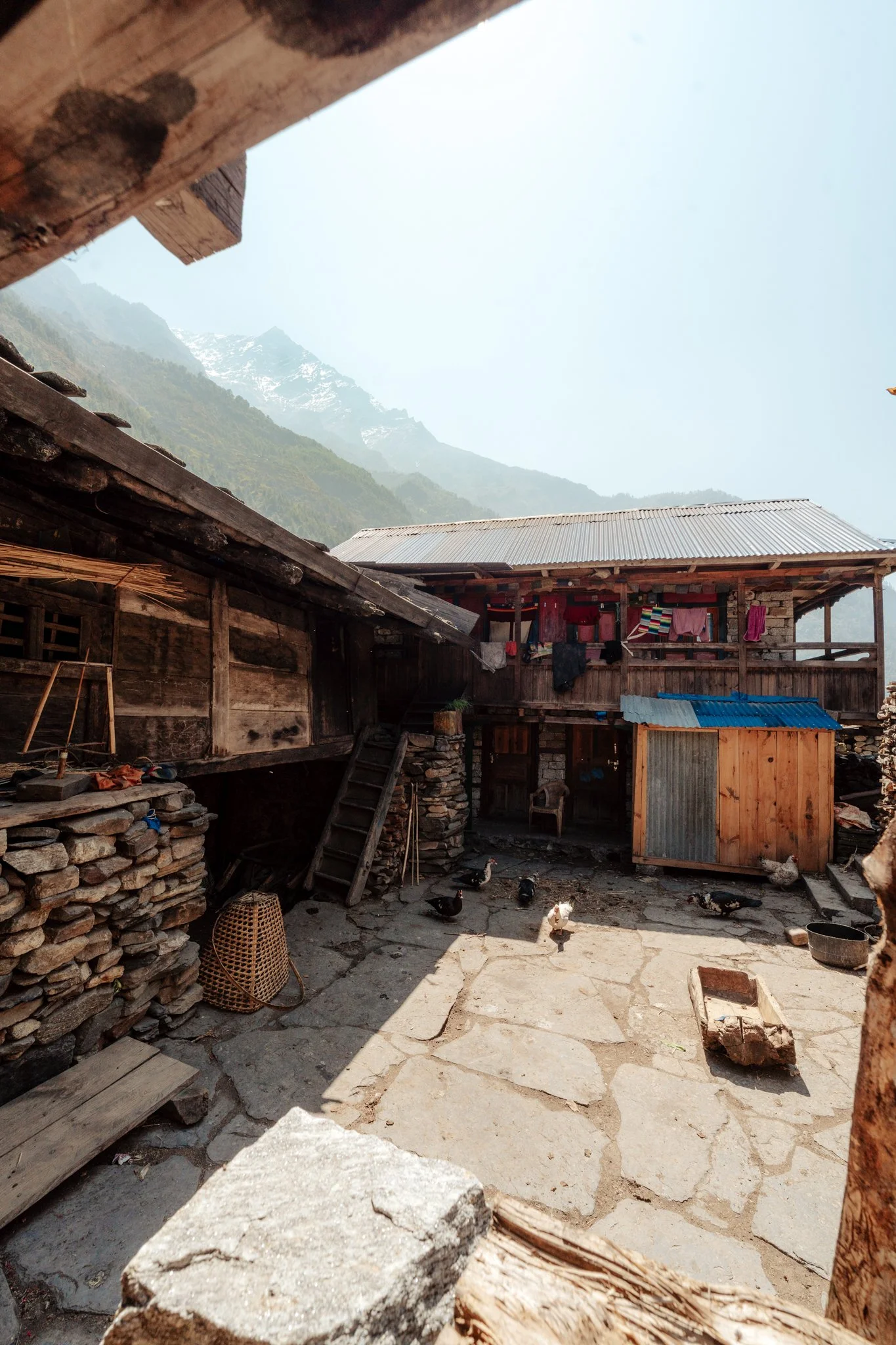
About 25 miles into the total trek we reached Bihi, an old village that feels like it's grown out of the rock itself. Everything is made of organic material, stone and wood and earth. Locals were farming terraced fields. It's one of the most beautiful, humble, lived-in places I saw the entire trek.
The Dog Bite
I have to give context for this one. At the start of our trek, Jiwan had said something we both forgot: "Animals here are dirty. We don't really keep dogs as pets. They can have diseases." Paige and I are both animal lovers and we'd been petting friendly-looking dogs the whole way up.
In Bihi, we walked down a narrow path. There was a tiny puppy. Cute. Sweet. Looking at us. Paige put her hand out gently for it to sniff. The puppy was scared. Without hesitation, it nipped her finger and ran away. The bite barely broke the skin, less blood than scraping your knee on a sidewalk. I cannot stress how small this was.
But Nepal has a serious rabies burden, and rabies is a disease with a 100% mortality rate if you contract it untreated. Even a scratch from an unvaccinated animal in Nepal is taken seriously. Post-exposure prophylaxis has to begin within 24 hours of contact.
What happened next was one of the most stressful afternoons of my life.
The Insurance Reality
We tried everything. Paige's husband Lance was on the phone trying to pull her US rabies vaccination history (turns out you have to request that record several days in advance, even from your own doctor, not an option on the trail). I was researching what happens if you don't have proof of pre-exposure vaccination. Jiwan was calling every village for miles asking if anyone had on-site rabies vaccines. Nobody did.
The next layer was insurance. Pay attention to this part if you're planning this trek.
Chase Sapphire Reserve travel insurance: only covers airlift from medical center to medical center. Will not do mountain rescue.
Garmin inReach with Star Insurance: couldn't even locate her. The signal was unreliable.
My Amex Platinum medical evacuation coverage: can't be used for someone who isn't a spouse or immediate family member.
The only option was for Paige to pay out of pocket for a private helicopter rescue, which would fly her directly back to Kathmandu where she could get post-exposure rabies prophylaxis at a hospital.
Please, if you're going on a trek like this, get a dedicated travel insurance policy that explicitly covers high-altitude trekking and mountain evacuation. Don't rely on credit card travel insurance. Don't assume your Garmin will save you. Get the real policy.
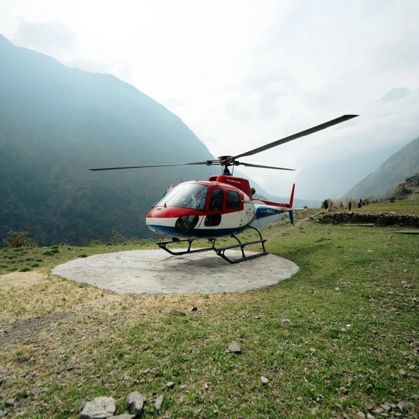
Paige's helicopter at Bihi. Four hours of waiting, then gone in two minutes.
The Decision
We had to decide: do I go with her, or do I keep going?
Paige and I are both extremely independent travelers. If I hadn't come on this trek with her, she would have come alone. If she hadn't been with me, I would have done it alone. We know this about each other. We made the calls that were best for ourselves, which in turn was the best thing we could do for each other. If I'd quit, she would have carried that guilt. Her getting back to Kathmandu fast was obviously the only safe call.
I'm telling you this because after I shared this story on my Instagram, people DM'd me suggesting I'd been wrong to let her go alone. People DM'd her suggesting she'd been ridiculous to "use her privilege" for a helicopter when "it wasn't that serious." It was that serious. We made the right calls. Jiwan and Das never once made me feel guilty about continuing, and they never once made Paige feel guilty about petting a puppy. Things happen. Things could have been so much worse.
Paige's husband, my own family on text, everyone was rallying. Paige is one of the strongest people I know. She is also an extraordinary photographer with credits at Adobe and Nat Geo, and she's the reason I was on this trek in the first place. Go follow her at @paige_tingey
The Wait, the Helicopter, and the Walk Onward
We sat in Bihi for about four hours waiting on heli permits. Eventually it came in, she boarded, and I watched it lift off. The first few hours of the trail without her felt like a different trip entirely. Wow. I'm just out here now. Just me and Jiwan and Das.
We lost most of the day, so we cut the original itinerary short and stopped for the night in Ghap instead of pushing to Namrung. This put us a full day behind schedule, but Ghap turned out to be one of the most beautiful, quiet villages of the trip. Few trekkers, hot gas shower, and a small hotel I can't even name because there was no signage I could find on the building. Beautiful mountain backdrop, which Jiwan, of course, said were "just hills."
Stats at end of day: 31.8 miles, 8,016 feet of elevation gained.
About My Boots
This is also the day I started getting blisters. Dr. Scholl's blister patches are not sponsored, not glamorous, and absolutely essential, they saved me. I also realized my Keen hiking boots were probably half a size too small. They're great boots, durable, waterproof, the Targhee Apex Mid is what I was wearing, but if I were doing it over, I'd size up half a size. My toenails on the descents from here on out had a rough time. Pair them with proper moisture-wicking hiking socks, the cheap cotton kind absolutely will not work on a trek like this.
Closure on the Paige Story
Quick update so you're not left wondering: Paige made it to Kathmandu the same day. She got her tetanus shot at a government-run hospital, which she described as something out of a horror movie, blood on the seats, people in the waiting room in extreme pain, and the rabies series at a private healthcare facility, which she said was fast, modern, and painless. She had to get a series of three shots over the following week. She is completely fine. She even went on a solo safari to Chitwan National Park (saw hippos, birds, incredible trees) before we reunited in Kathmandu.
The contrast Paige drew between the two hospitals stuck with me. We complain a lot about healthcare in America. Watching her describe what she saw in the public hospital reframed a lot of that for me. You can criticize the US system and still be able to acknowledge what real privilege looks like.

DAY 4: Ghap → Shyala (12.6 miles, 44.4 cumulative, 13,877 ft)
First Morning Solo
I woke up alone on the trail without Paige for the first time. I knew everything would be okay. I was also a little lonely. The morning sun was coming through the mountains. The air was clearer than it would be later in the day, so we got an early start.
The landscape changed dramatically on this stretch. The rocky cliffsides and rivers gave way to lush forest trail. No more cars beyond this point, only mules, foot, and the occasional motorbike that I genuinely have no idea how it got up here.
The Bakery Stand at the Top of the Stairs
We climbed a steep stone staircase into a small village with a stunning valley view, and at the top there was the most charming bake stand. Fresh croissants, cinnamon rolls, bread, fresh-squeezed apple juice, chocolate truffles, Red Bull, and hand-knit goods made from local yak fur. A young girl was running it. I had a tiny shot glass of the apple juice. It cost a couple cents and Jiwan helped me pay.
Critical warning, because this almost killed someone the same week I was on the trek: Do not drink "fresh" juice on this trek even if they tell you it's made with filtered water. It often isn't. Someone on a similar dates as me got helicoptered out after drinking a full glass of orchard apple juice. From this point forward I drank only filtered water and the occasional sip of Coca-Cola from Jiwan's bag. The shot glass I had was small enough to be fine, but I will not be ordering juice in the mountains again.
Podcasts Saved Me
I realized somewhere on this stretch that I was going to need to occupy my brain to keep moving. So I plugged in my AirPods and started listening to The Restless Historian. The episode on Tupac Amaru and the Inca Empire is incredible, highly recommend if you like history. Download way more podcast episodes than you think you'll need. I burned through everything I had in my library by day four and was rationing music for the rest of the trip.
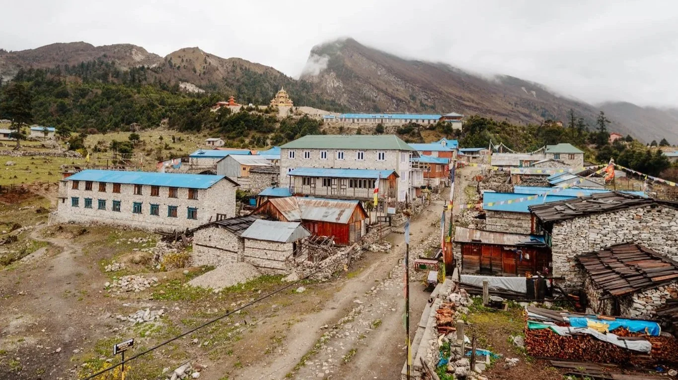
Namrung. The town I was supposed to sleep in.
Namrung — The Town I Was Supposed to Sleep In
Halfway through the day we passed through Namrung at 2,650 meters. Colorful, monks visible in the streets, a beautiful entrance gate, a town square ringed by mountains, tree leaves bright yellow at this time of year. This is where we were supposed to have stayed the night before, in cute communal hut accommodations under string lights, sharing meals with other trekkers. The dog bite changed all that. I'll never know what that night would have been like, and I'm okay with it.
This is also where I got pulled into the most random, joyful little moment of the trip. A local woman had her iPhone propped up against a window, recording video. She called me over: "Be in my video!" She didn't really explain what we were doing, she just hit record and started dancing. "Follow my lead." She spoke a little English, enough. I learned this trip that Nepali people love dance trends and TikTok. Things had been heavy since Paige left. Who am I to say no? I joined her dance for about a minute. I have no idea where that video lives now, but it was such a sweet small thing.
Mani Walls
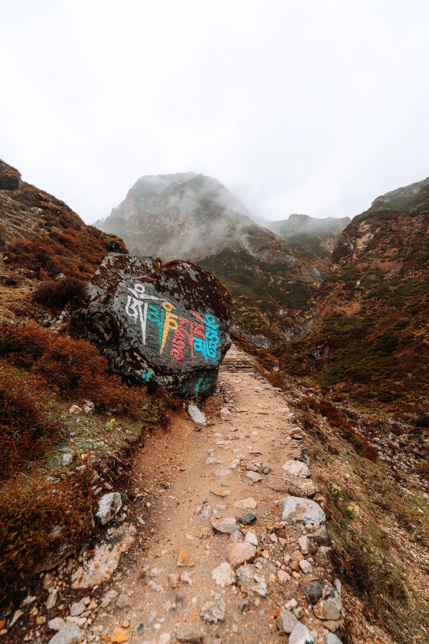
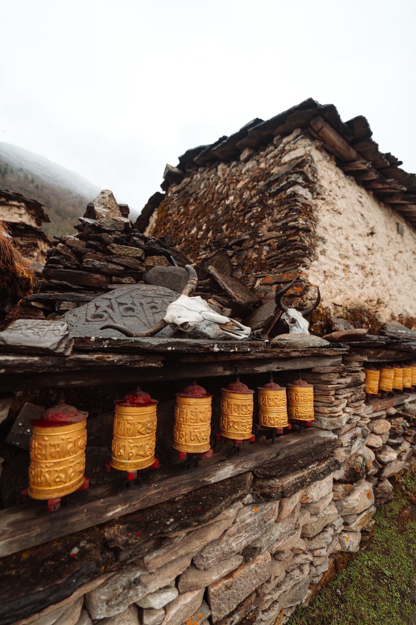
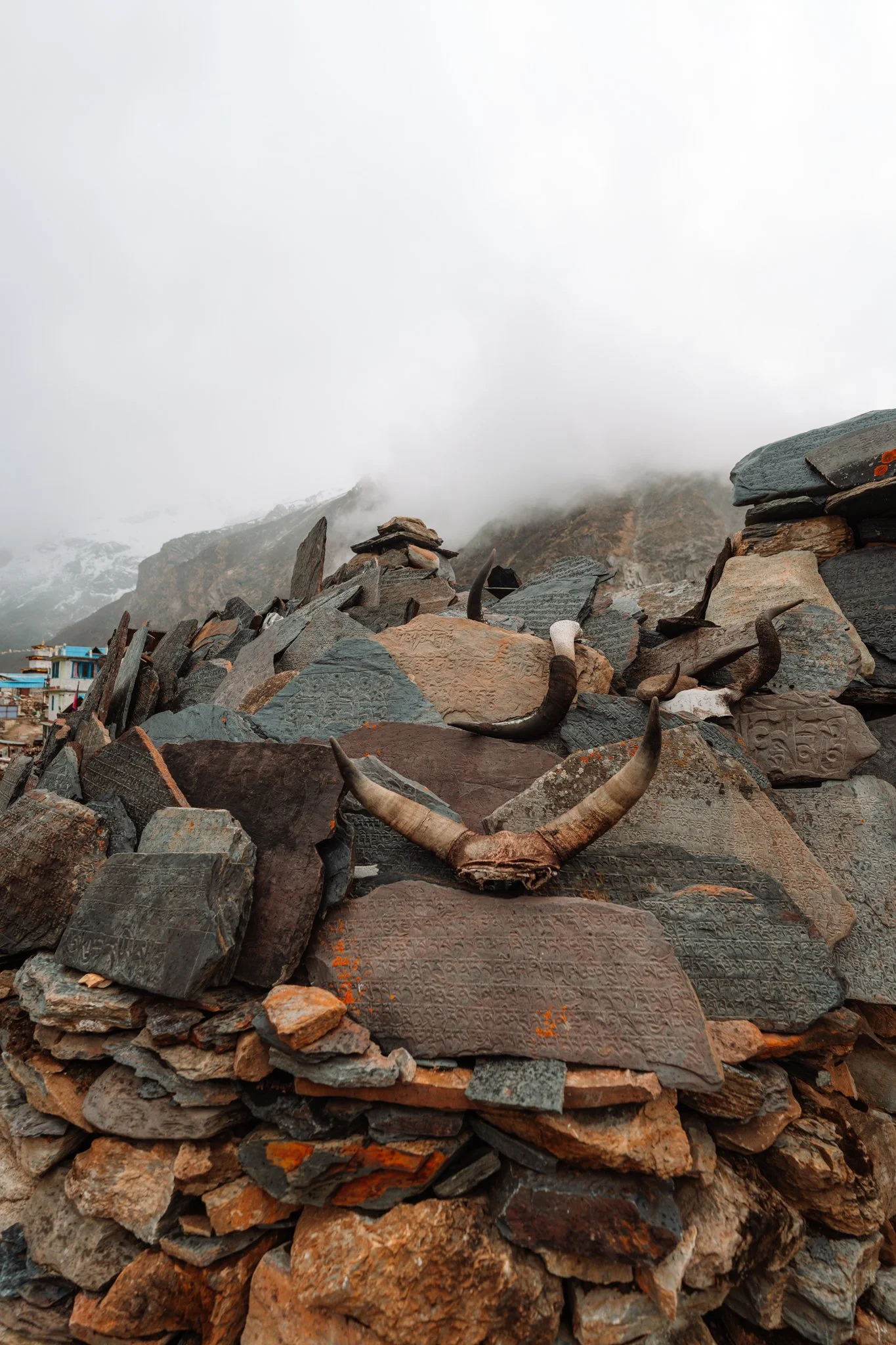
This stretch is also where the mani walls start showing up everywhere. These are long stone walls made of carved slabs, each etched with the prayer "Om Mani Padme Hum." Some are hundreds of meters long. Some are centuries old, with moss growing on the stones. The Buddhist convention is to walk to the left of the wall, keeping it on your right, out of respect, the way you'd circumambulate a stupa. Jiwan reminded me of this every time we passed one. They are so beautiful.
The Cliffside Monastery
At exactly 40 miles in, we stopped for lunch, fried rice, black tea, at a teahouse with a balcony view of endless valley fields. On the opposite side of the valley, built directly into the cliff face, was a small remote monastery. How do you even get up there? I kept asking. If you're a monk meditating in that monastery, your view is unbeatable, and the silence must be incredible.
Shyala — The View I Didn't Get
The terrain shifted again, out of the Colorado-like mossy forest and up into proper alpine elevation. By the time I reached Shyala I was wearing pants over leggings, a tank top, a long-sleeve, sometimes my light down jacket. Cloudy. The last hour of the hike was rain.
Here is the cruel part: Shyala is supposedly the location of the best Manaslu view of the entire trek. There's a stunning, ornate red-and-gold monastery with the mountain rising directly behind it. I saw none of it. Total cloud cover. Three days into rain and fog and clouds, I was bummed. I tried to keep my morale up.
I did, however, run into the trekkers from my original chaos bus. Seeing familiar faces for the first time since Paige left almost made me cry. I was so happy. I was also so tired I clocked out and went to bed early without socializing much.
Every teahouse so far had reliable enough Wi-Fi to upload Instagram stories and reach my family, and every one had a charging port for my electronics. Bring a portable charger regardless, even a small one. This was one of my first nights I really needed my sleeping bag for warmth, and the wood-burning stove in the common area became the heart of the building. Everyone huddled around it. We all swapped stories from the day. This is when I started understanding that the social fabric of this trek is part of what makes it.
Shyala. Allegedly the best Manaslu view on the trek. I'd have to take their word for it.
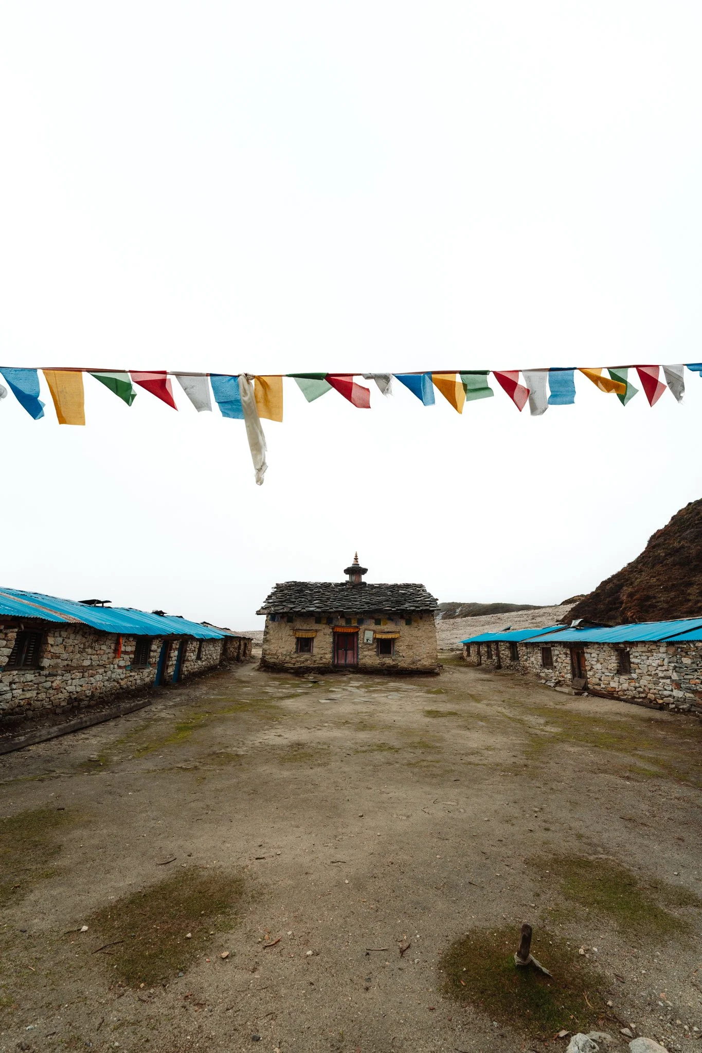
DAY 5: Shyala → Pungyen Gompa → Samagaon
The Rain
I woke up to heavy clouds and the first day of full rain. I posted to Instagram asking for good vibes. Did not work.
Here's where I tell you about the single best gear decision I made for this trek. About a week before flying out, I had a panic moment when I realized I didn't own a real rain jacket. I went straight to Arc'teryx and stood there in horror at the idea of spending $400 on a coat that felt like air. I bought it anyway. This Arc'teryx rain jacket has a tiny brimmed hood that stops rain from running into your eyes. It's lightweight. It's cute (light blue, matched my hat). It also did not even come close to covering my whole body.
So picture this. I am wearing a $400 Arc'teryx jacket. Over it I have layered a $1.50 transparent plastic poncho I bought from a roadside bodega, because the poncho is longer and protects my pants and my backpack. This was my outfit for the day. And I have never been more comfortable in the rain.
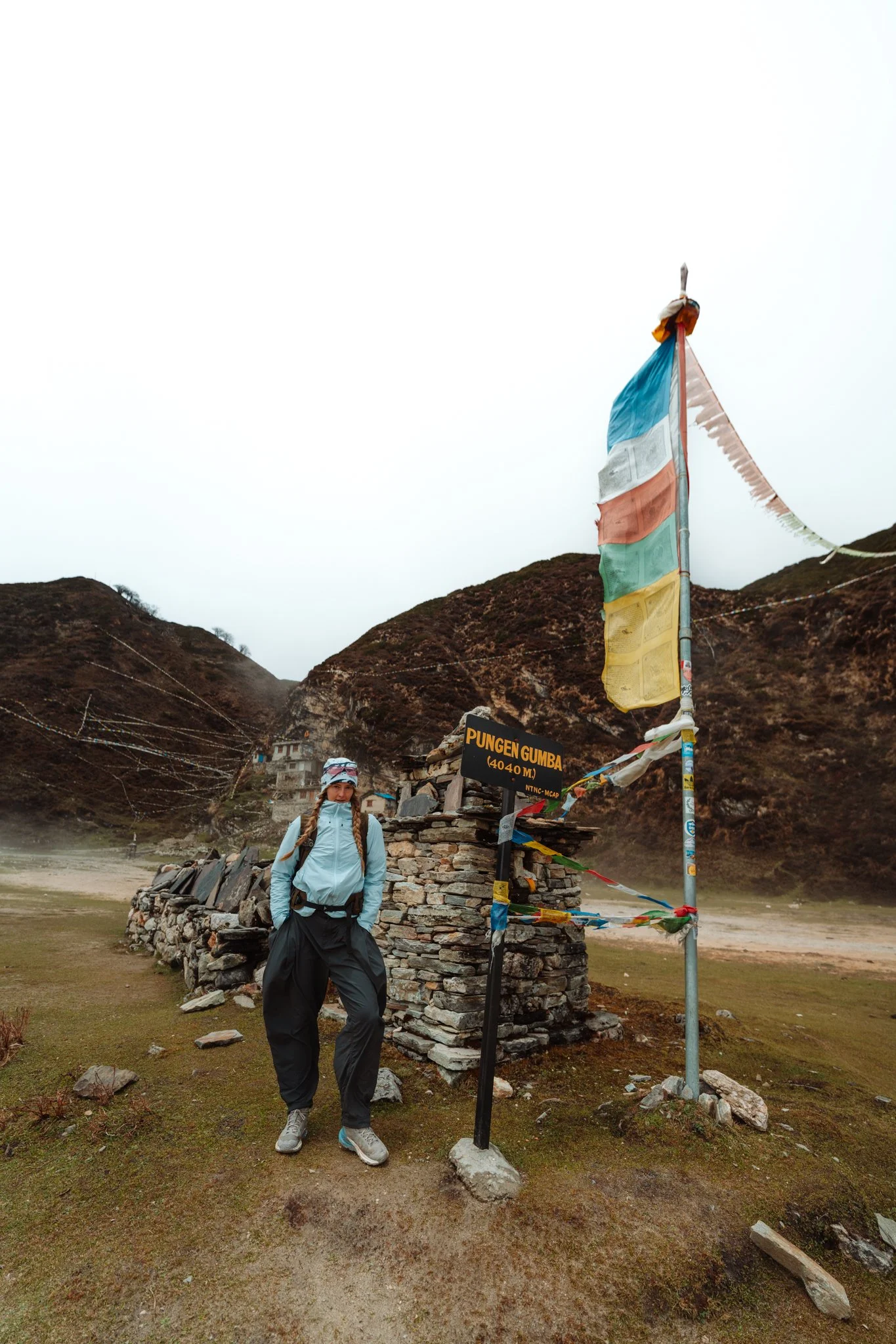
The Side Trip to Pungyen Gompa
From Shyala you can take a side trip to Pungyen Gompa, a remote monastery on a high plateau. Most trekkers skipped it because of the rain. I went anyway. I was alone up there for almost the entire walk.
The terrain is treacherous because of recent rockslides, and Jiwan offered to carry my camera bag on his front in addition to his own pack so I could move at a steady pace. Of course he did. I have to do a sidebar on Jiwan now because I can't keep going without explaining who he is.
A Sidebar on Jiwan
Jiwan was born in a rural mountain village in Nepal into a big family. By age seven he was already porting goods between villages on foot. By eleven he was carrying tourists' bags as a working porter. He's 28 now. To become a guide in Nepal you have to porter for at least five years first, so guides know the trails, the peaks, the altitude, the weather, and the villages from the inside out. Jiwan has been a licensed guide for 12 years and has crossed Larkya La approximately 100 times.
He speaks Nepali, multiple mountain dialects, Tibetan, fluent French, and pretty good English. He's been guiding mostly French-speaking groups the past few years, so his English was a little rusty when I met him.
And here's the kicker. Some years ago, to make a better life for his siblings and his family, he founded a noodle production company in Kathmandu. Hand-pulled, traditional Himalayan thick wheat noodles, dried on racks for three days, packaged on-site, distributed to restaurants in Kathmandu. He runs this with his wife. He has a daughter and his father lives with them. The biggest constraint on his business is that the noodles take three days to dry and warehouse space in Kathmandu is brutally expensive, so his current obsession is figuring out how to dry them faster.
I'm telling you about him now because the small acts of kindness Jiwan did on this trek, packing fruit, bringing me yogurt later, carrying my camera bag in dangerous terrain, those came from someone who has been thinking about other people's well-being for his entire life. Book guides like this. They are the entire trip.
The Plateau and the Avalanches
Once we got up onto the plateau, there were no other people for miles. The grass was vivid green. The mountains were so big that when I looked up at the cloud breaks, instead of seeing blue sky through the gaps, I saw more mountain. The peaks above me were taller than the clouds. I had multiple breakdowns this day. The sheer grandeur of where I was. If I'd had a clear day up there, I think it would have rearranged my brain entirely.
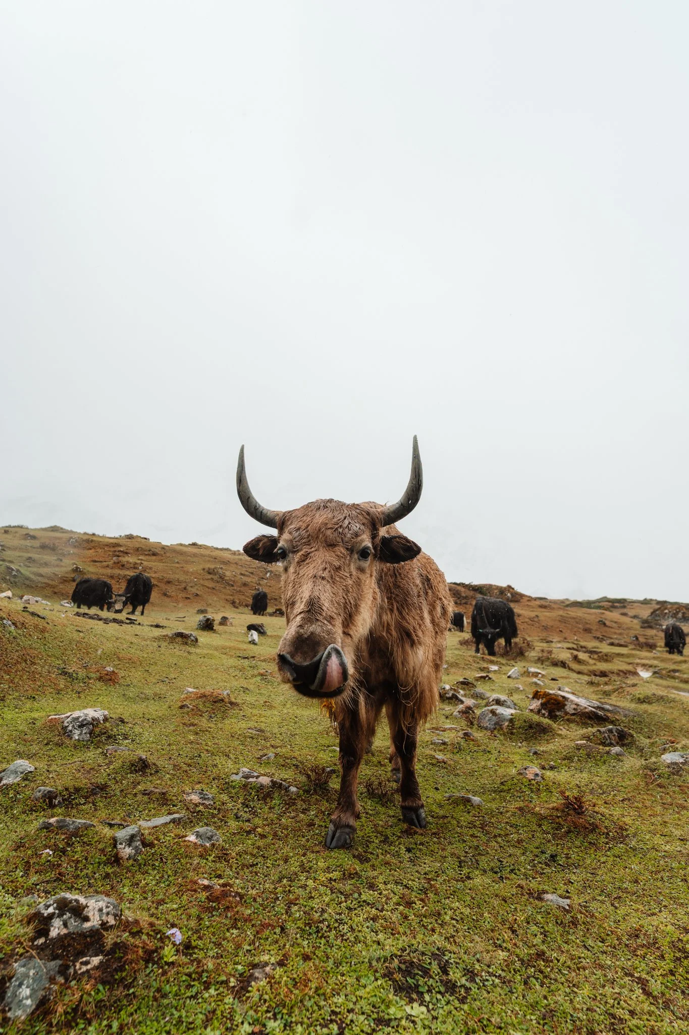
Yak herds grazed across the plateau, bells chiming softly. Even though I couldn't see the peaks, I could hear and feel the avalanches and rockslides, every five minutes or so a deep booming sound from somewhere far in the distance. The Himalayas in spring are warming up, the snow is melting, water is loosening everything. The mountains are constantly shifting under their own weight. Jiwan kept reassuring me we were safe. I felt the volatility of the place in my bones.
Pungyen Gompa Itself
The monastery is built into the side of a cliff, and Tibetan prayer flags run from the surrounding peaks down to the building like a giant web. From a distance, in the fog, it looked like something out of a dark fantasy movie. Spooky, surreal, gorgeous. I shouldn't compare a holy monastery to a villain's lair, but you'll see what I mean if you go.
It was completely abandoned when we visited. End of the season. The monks come and go.
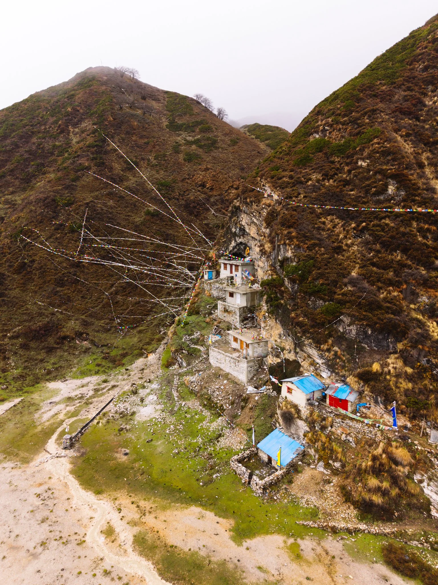
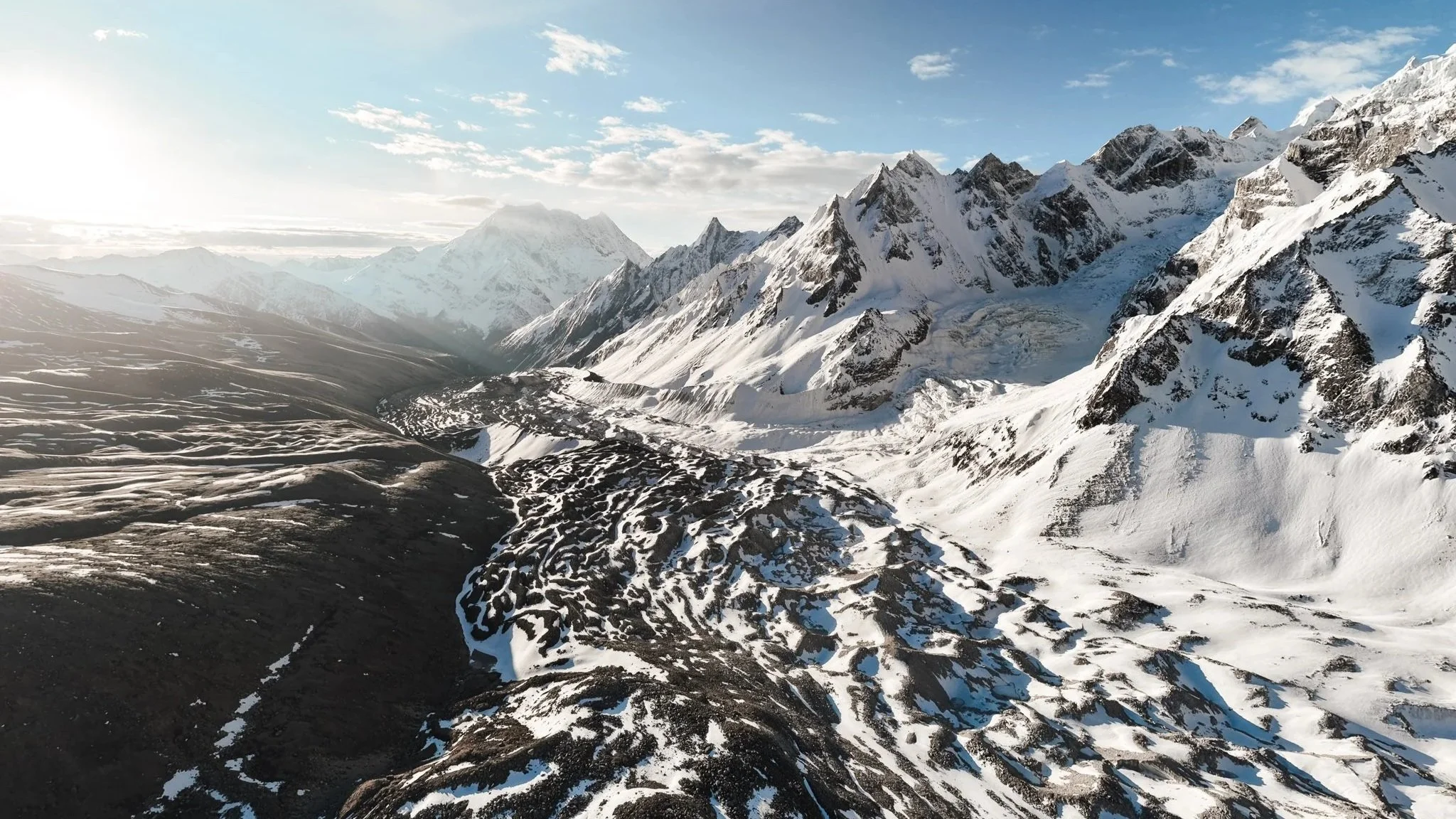
Pungyen Gompa from the air. The prayer flags run from the surrounding peaks down to the monastery like a spider web.
A note on Beyul Kyimolung — the Hidden Valley of Happiness
Standing in the fog at Pungyen Gompa, Jiwan told me about Beyul Kyimolung, the Hidden Valley of Happiness. According to Tibetan tradition, Guru Rinpoche identified and blessed this valley over 1,200 years ago, sealing it as one of eight sacred hidden valleys of the Himalayas. It's said to be guarded by deities who appear as snowstorms, mists, and snow leopards. The further you walk into it, the more wild animals lose their fear of humans. I'm not Buddhist, and I don't pretend to fully understand it, but standing in the fog at 4,000 meters with no other humans around, hearing avalanches in the distance, the legend felt very plausible.
The Tea Hut and the Lonely Man
On the way back, we found a tiny stone tea hut with a tin roof. One older man inside, alone. He made us three cups of black tea and we shared a banana biscuit. (Sidebar: Jiwan brought endless snacks for the entire trek, Snickers, toasted trail mix, little packets of dried nuts and fruit. He'd offer them to me constantly because at altitude my appetite was dying. Pack guides who pack snacks.)
I asked the tea hut man if he ever gets lonely up there. He said yes. Jiwan told me his story afterward, he comes seasonally for tourism income. His wife is a teacher in Kathmandu. He's just here for the trekking months, then he goes home. I sat with that. Life is not everything I'm capable of understanding.
Cowslip Flowers and an Anime Theme Song
On the descent, the trail was lined with bright yellow wildflowers, locally called cowslip. Set against the green grass with yaks grazing in the middle distance, I genuinely felt like I was inside an episode of Frieren: Beyond Journey's End. The theme song played in my head all afternoon. I cried. Again.
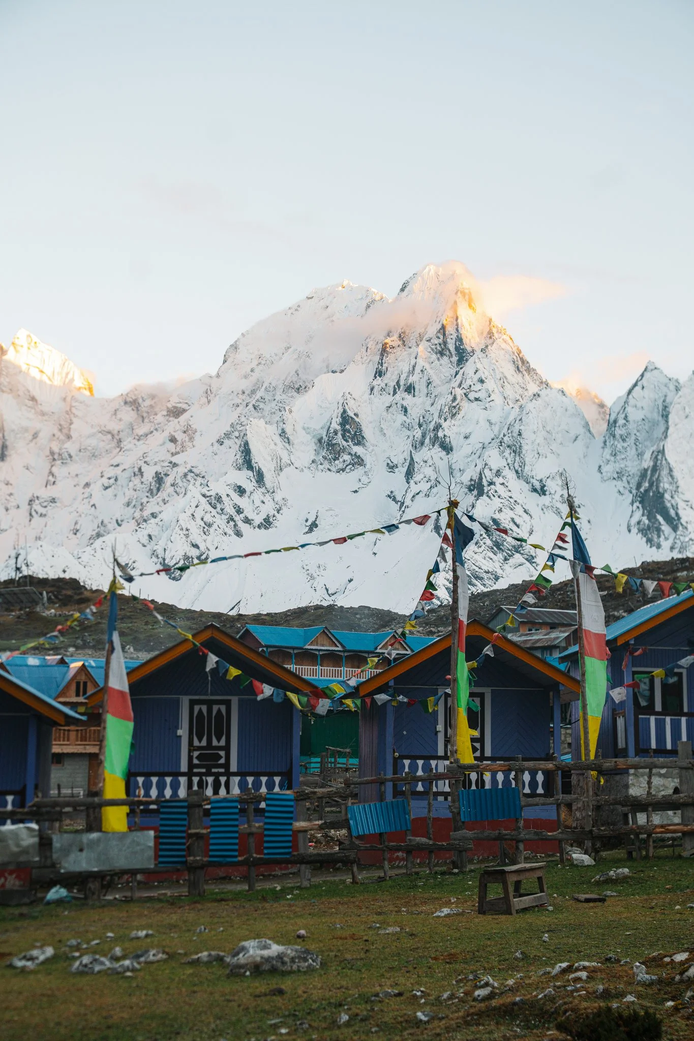
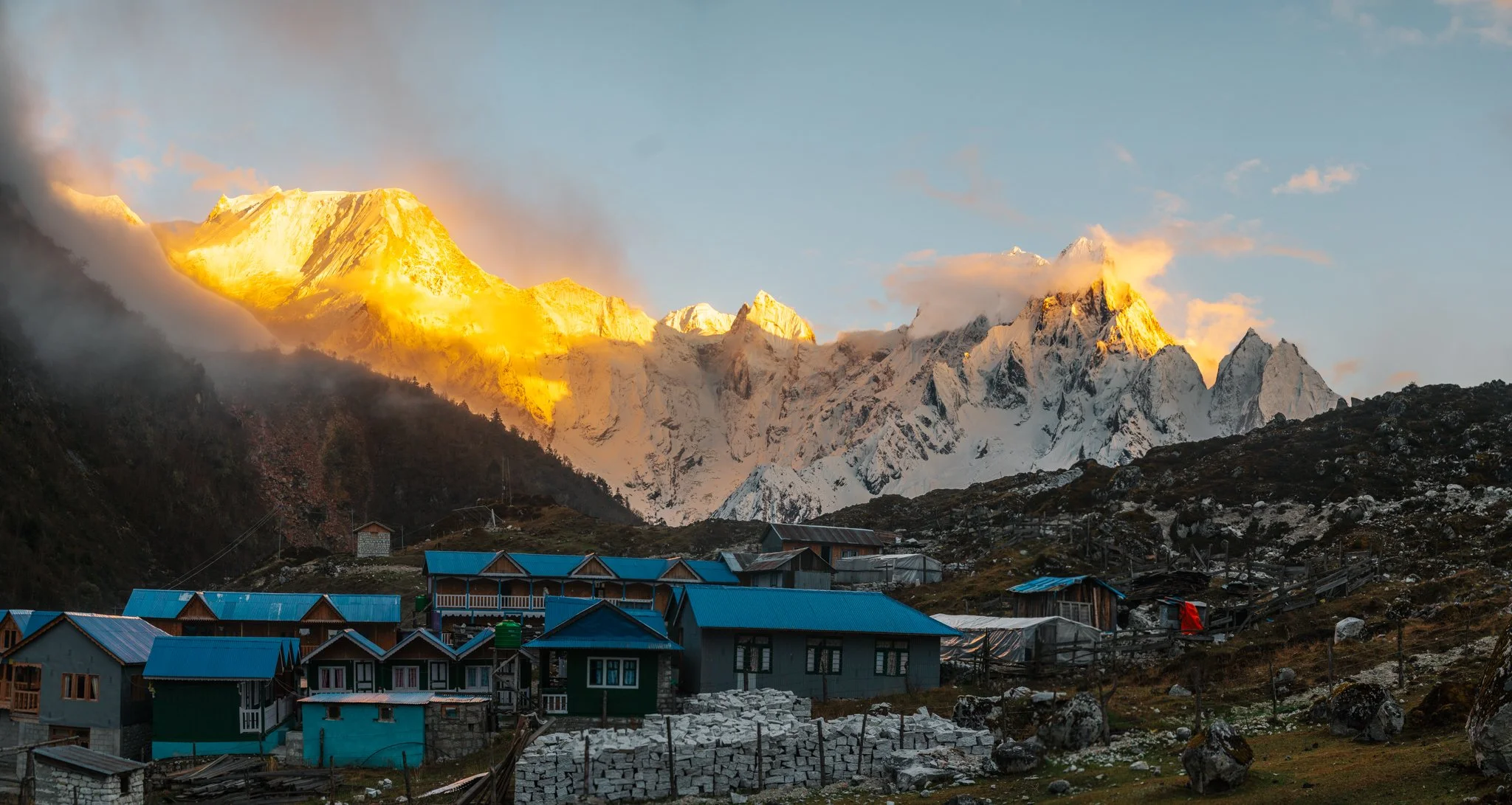
Arrival at Samagaon
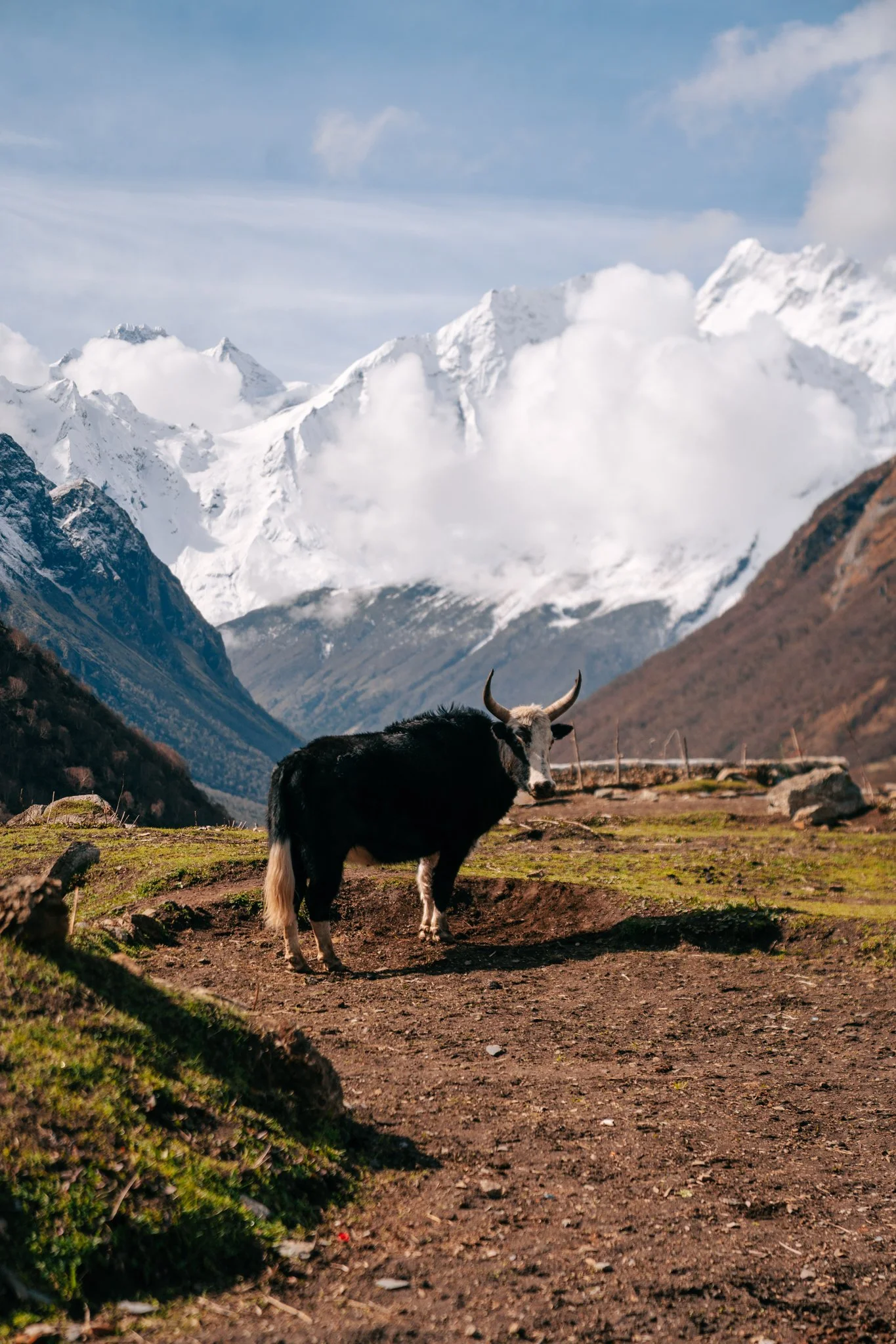
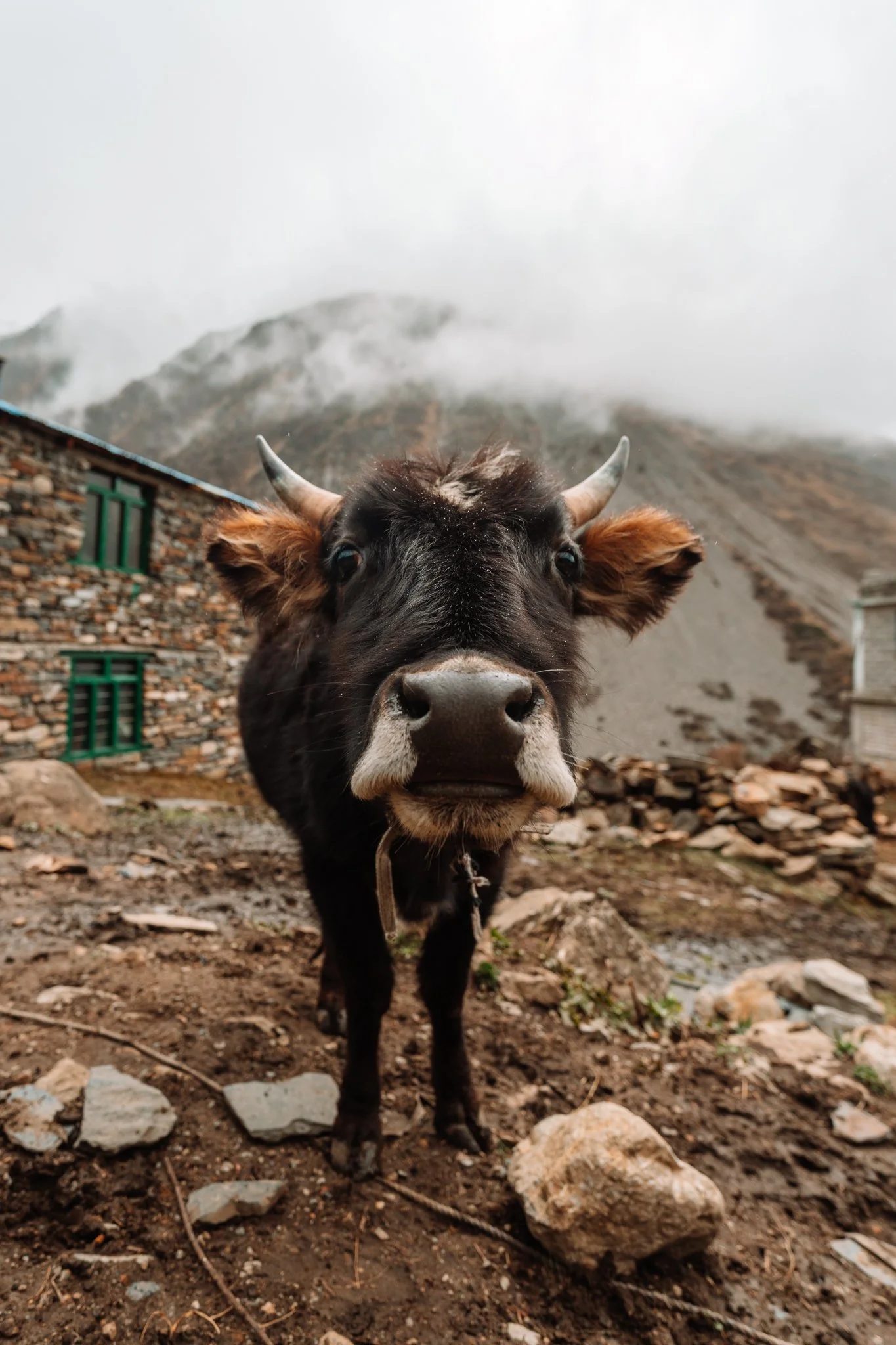
Fog and rain rolled in as I descended toward Samagaon, which is one of the benchmark villages of the entire Manaslu Circuit and feels like stepping back into the 15th century. Stone buildings, wooden frames, a river running through the middle, yaks walking down the streets. I will say this town had the most yak droppings of anywhere on the trail, and it was raining, so everything was a squishy muddy mess. Waterproof boots are non-negotiable.
Jiwan remembered me mentioning that I love yogurt at home. He walked me into a hut where they had a yak out front and asked the family if anyone in the village made fresh yogurt. (I was internally panicking about unpasteurized dairy at altitude, when I told him, he understood instantly and dropped it.) The fact that he was even asking was the sweetest gesture.
My hotel that night was one of my favorites of the trip, a corner double room overlooking the village, very clean, ridiculously fluffy bedding. I regret not photographing the room. I just wanted to sleep, and I slept beautifully.

DAY 6: Samagaon → Samdo (~3.5 miles, 61.32 cumulative, 17,852 ft)
The Lake We Couldn't Visit
Breakfast was a huge bowl of muesli with warm milk, apples, and honey. Plus the fruit plate.
The plan for today was to swing by Birendra Lake, a turquoise glacial lake at the foot of Manaslu, then walk the trail along its shore on the way to Samdo. The water levels were too high after days of rain. The shore trail was unsafe. We had two choices: hike down to the lake then backtrack uphill to rejoin the main trail, or skip the lake and go straight to Samdo.
We took the L. I got a quick glimpse of the lake's turquoise from the viewing point above, then we cut directly to Samdo.
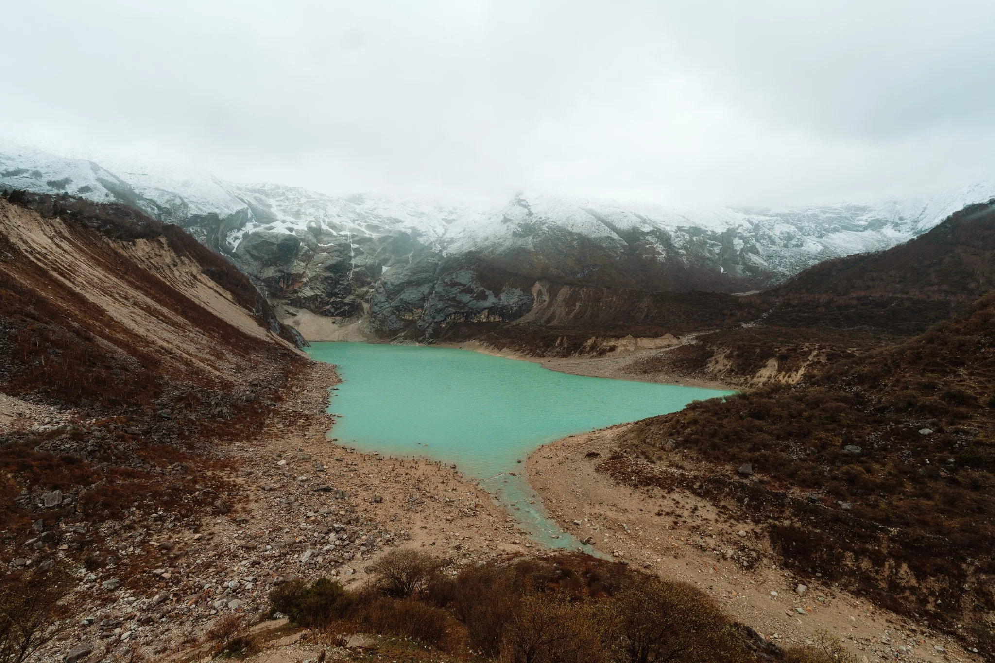
Birendra Lake at the foot of Manaslu. We were supposed to walk along that shore. The water was too high.
Nepali Speed
I don't know what got into me but I was in such a good mood today that I put on music in my AirPods and just cruised. Jiwan said I was hiking "Nepali speed." We made it into Samdo by 11:30 a.m., which gave us hours to kill in this little village.
End-of-day stats: 61.32 miles total, 17,852 feet of elevation gained. I have a Strava screenshot that I will treasure forever.
The Boredom Spiral
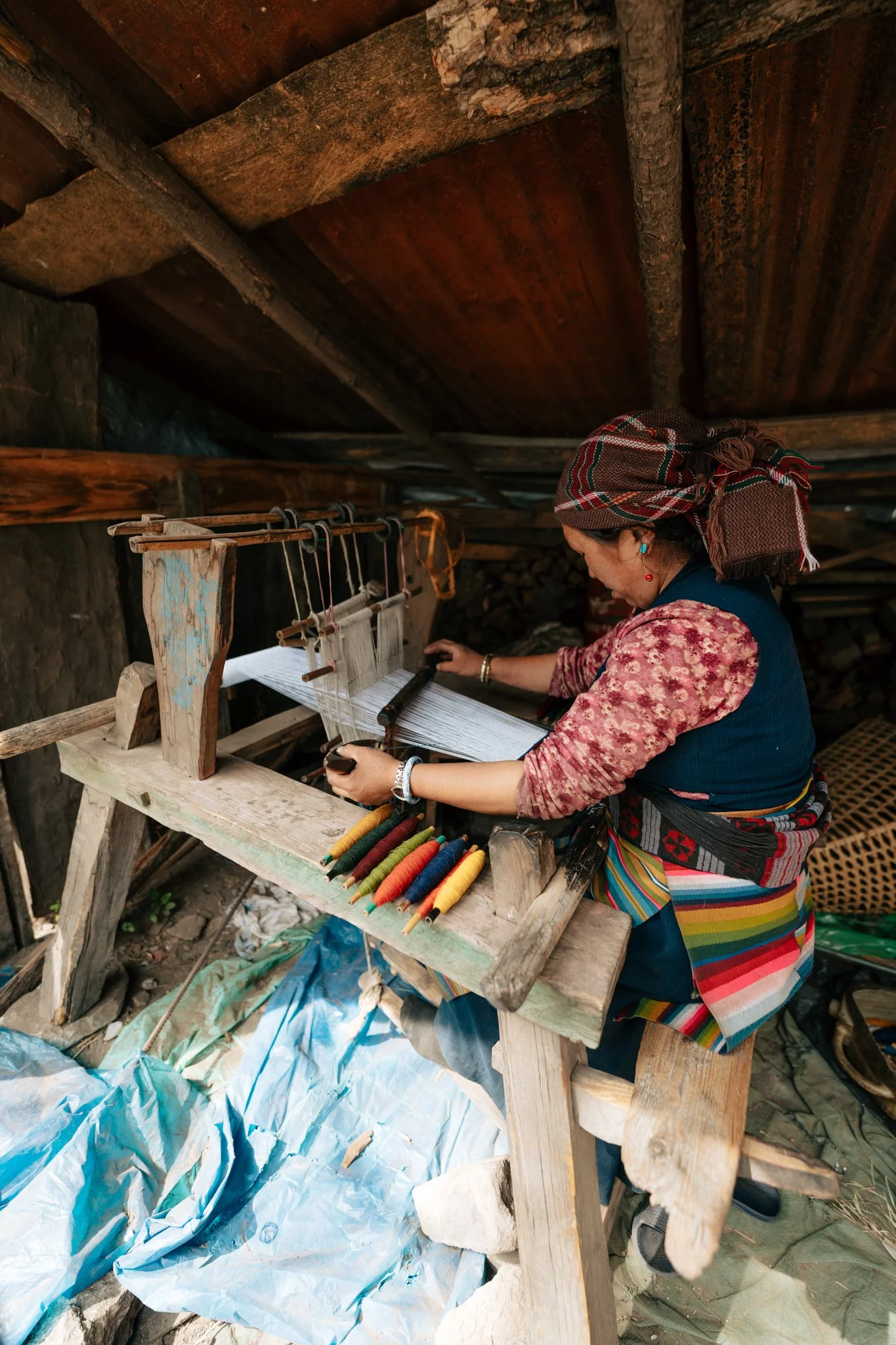
Here's a thing nobody tells you about high-altitude trekking: when you have a short, fast day, you end up with a lot of unstructured time, and your brain at 12,000 feet is not a great brain. I walked the village with Jiwan, visited an older woman's home and watched her knit (so beautiful, so quiet, so present), and then I had so much free time that I sat staring out a window for hours.
What I wish I'd packed: a mini watercolor set, a journal, a deck of cards, a Kindle, a book, literally anything to give a tired brain something to do. I genuinely could not justify the weight of any of it before I left, but I would have given anything for a Kindle on this afternoon.
Instead I watched a cow drama play out across the village in real time. I sat there for two or three hours watching it. I am realizing as I type this that I watched a cow for three hours. Anyway. There was a beautiful mother cow with an all-white baby calf. A man came out of one of the homes, picked up the baby calf, and walked away with it. The mother seemed unbothered at first. Slowly she started looking around. She walked the entire village. She stood in front of doors and made the saddest moo sound. I was incandescent with rage. I was sitting at a window seething. They better bring this damn baby back. I went to bed not knowing if she ever did.
I also went to bed without showering for the second night in a row. Body wipes saved me. I really cannot recommend these body wipes enough.
The mattress was great. Two big fluffy blankets. I slept hard.

DAY 7: Saga Dawa in Samdo → Dharamsala (~4 miles, 19,494 ft cumulative)
The Sky Cleared
A knock on my door before sunrise. Jiwan had promised to wake me up if the sky was ever clear, and on this morning, it finally was.
I threw on my boots and my hat, didn't bother with my hair, and ran outside. Blue sky. The first real blue sky in days. And the most ridiculous, soaring, snow-covered mountain wall I had ever seen in my life, visible from the edge of the village. I started crying. I pulled out my phone and posted hundreds of Instagram stories to share it with everyone who'd been following along. I literally filled three and a half full Instagram highlights, which if you don't know, means over 350 stories. I needed everyone to see this with me.
And then it turned out it was Saga Dawa.
Saga Dawa is the holiest day in Tibetan Buddhism. Every good deed counts a thousand times.
What Saga Dawa Is
I don't want to misspeak about this because I'm not Buddhist and I'm just doing my best to learn. Saga Dawa is the holiest day in Tibetan Buddhism, celebrated in the holiest month, and it commemorates the Buddha's birth, enlightenment, and death, which according to tradition all happened on the same full moon. Every good deed performed during the month of Saga Dawa is said to carry a thousand times the merit. Samdo is the closest the Manaslu Circuit gets to the Tibetan border, and the village is mostly ethnically Tibetan, so the celebration here is significant.
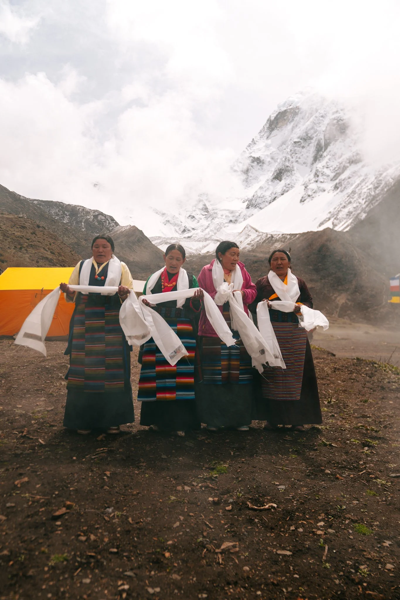
Jiwan asked the village if we could stay and observe. They said yes. They draped me in a khata, the white ceremonial scarf given to honored guests in Tibetan Buddhist tradition. I have never felt more welcomed in my life.
Saga Dawa morning in Samdo. The day the sky finally cleared.
The Ceremony
We were invited into the headman's home first. He was performing a ritual chant around the home's hearth. They served me Po Cha, Tibetan butter tea, made with black tea, salted yak butter, and a wooden churn. It tastes more like a salted broth than tea, and at altitude in the cold, it's perfect. They also gave me dried fruit and roasted barley flour called tsampa. Tsampa is the most sacred food in Tibetan culture, barley grows where almost nothing else will. Part of the ritual is taking a palmful of tsampa or rice and throwing it into the wind with your right hand as an offering. I got to participate.
Then we walked to the larger ceremonial hall where the whole village had gathered. The men of the village were seated around the perimeter. The women were serving tea and watching the children. Even the little boys were lined up around the room. I stood in the back with my white scarf on, and the kids came over to investigate my Sony camera. They didn't understand how it worked, and I felt bad that the LCD was broken, but they loved the clicking sounds. They were trying to take photos, trying to grab it from my hands, completely fascinated. I let them.
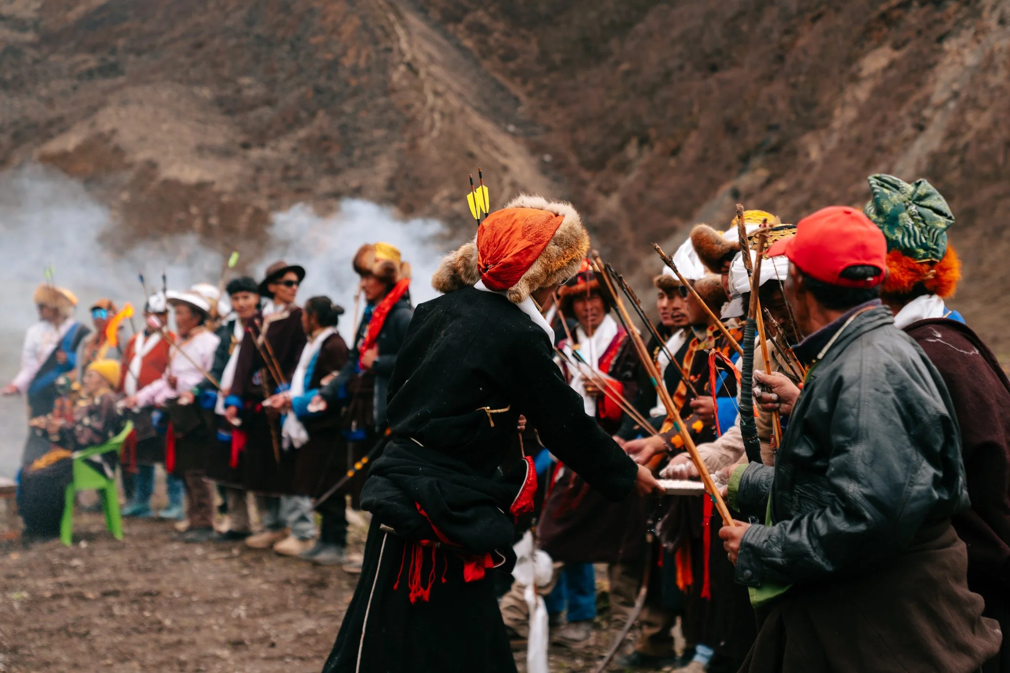
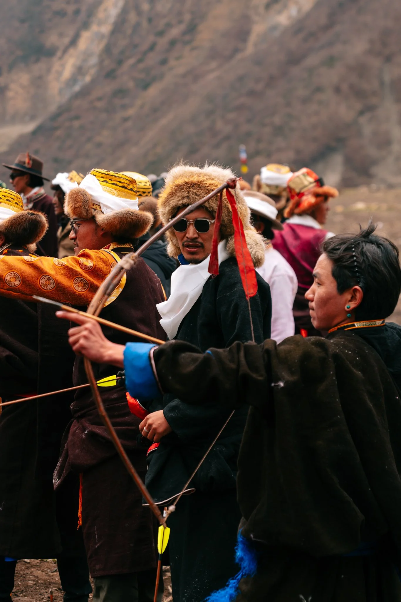
After the chanting came a horse race. Men of the village dressed in bright red ornate clothing, jumped onto small local ponies, and rode off in a furious procession out of the village. Women of the village sang in a near-yodeling style, religious songs, while juniper branches burned in big stone braziers and incense smoke trailed behind them. They held up scarves to the men leaving on horseback. It was the most beautiful thing I've ever witnessed.
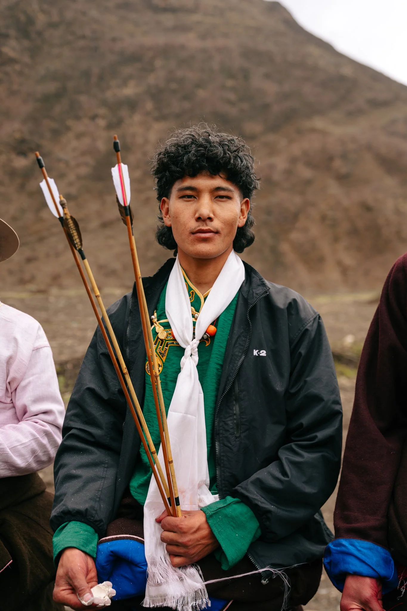
The horses came back ten or fifteen minutes later. Then came the archery competition. The men lined up shoulder-to-shoulder and fired all at once at a single target across a wide field. A man named Tsering, a common Tibetan name meaning "long life," held his draw longer than everyone else and hit the target. The village erupted. They picked him up. He was the winner.
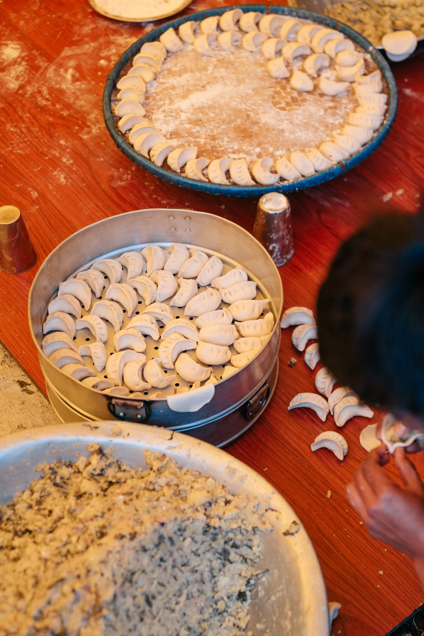
And then we walked to a third location where the village's young people, in their twenties and thirties, were sitting around a giant wooden board rolling out momo dough. Inside a huge silver bowl was the filling, local high-altitude potato, foraged greens, mountains of chopped shallots, garlic. A spicy red dipping sauce was being made from scratch alongside it. Steam baskets stacked four high were cooking the momos. An older woman managed the orders, plating them up, ferrying them out to the men who had finished the archery. Almost everything came from the village itself, the potatoes were grown there, the greens were foraged from the slopes, the shallots and garlic harvested from village gardens. Only the tomatoes for the sauce came from a jug.
I want you to understand: this is what holiday celebrations look like in the rest of the world too. Families dressed up. Grandmas taking pictures of grandkids on their phones. People wanting to remember things. It is exactly the same instinct as Christmas in America, just dressed in 1,200 years of Tibetan tradition. I was so honored to be there.
The Ascent to Dharamsala
We left Samdo and started the climb to Dharamsala, the last shelter before Larkya La Pass. It's not a long hike, only a few miles, but it's steep, and you gain almost two thousand feet to land at 4,460 meters.
Dharamsala is not really a village. It's a tiny stone shelter complex where everyone clusters before the pass. They prepared us mentally for what was coming:
Almost 50% less oxygen than sea level
No internet
No power, charge everything in advance
Very cold, keep all layers accessible
Mittens essential, plus a solid headlamp [link: https://go.shopmy.us/p-56889753] for the 3 a.m. start
3 a.m. departure tomorrow
The "rooms" are huts where the entire floor is a cushioned platform that sleeps four to five people. My hut had me, a solo female traveler from the Netherlands who had just quit her teaching job to do van life and was the coolest person I met on the trail, and a young couple from Israel I exchanged maybe six words with. Dinner was a noodle soup with way too much egg in it (I do not like egg in soup) and I barely ate. I tried to compensate with bag snacks. The fog was so thick I couldn't see twenty feet in any direction.
The Sleep Stack
I went to bed wearing my warmest down jacket over a second lighter down layer, all of my Helly Hansen base layer top and Helly Hansen base layer pants a neck warmer, my mittens, my hat, my wool sleeping socks, my thermal sleeping bag liner, my actual sleeping bag, and a thick blanket on top. Locked in. Cozy. Ready.
Side note about sleeping socks: bring a dedicated pair of clean wool socks just for sleeping. Your hiking socks will be sweaty and cold. Clean dry sleeping socks are a small thing that matters a lot at altitude.
The Altitude Nightmare
I had a dream that I was suffocating. Drowning. I was trying to call for help but nobody in my dream spoke my language. I woke up gasping, clawing at my neck and the layers around it, sitting up in the sleeping bag with strangers sleeping on every side of me. Pitch black. I had to calm myself down for several minutes.
This was the moment I realized: the air actually is hard to breathe up here.
Let's talk about Diamox. I got a prescription before the trip via Teladoc. The doctor I spoke with asked about my route, the elevation profile, and how many days I'd be at altitude, and prescribed acetazolamide 125mg, twice a day. I picked it up same-day at Walgreens. I'm not a doctor. You cannot take Diamox if you're pregnant or have liver issues. You should not take it long-term. Do your own research and talk to your own doctor.
I started taking it in Samdo, a day and a half before Dharamsala. The important thing to understand is that Diamox prevents and treats acute mountain sickness, it does not make 4,500 meters feel like sea level. I had no headache, no nausea, no AMS symptoms. I was just genuinely uncomfortable with the amount of available air. That feeling Diamox cannot fix.
I lay in the dark counting down the hours until I could leave the hut and start hiking again. Hiking I can do. Lying in a dark hut in thin air, surrounded by sleeping strangers, having a panic attack about whether my lungs are functioning correctly, that I cannot do.
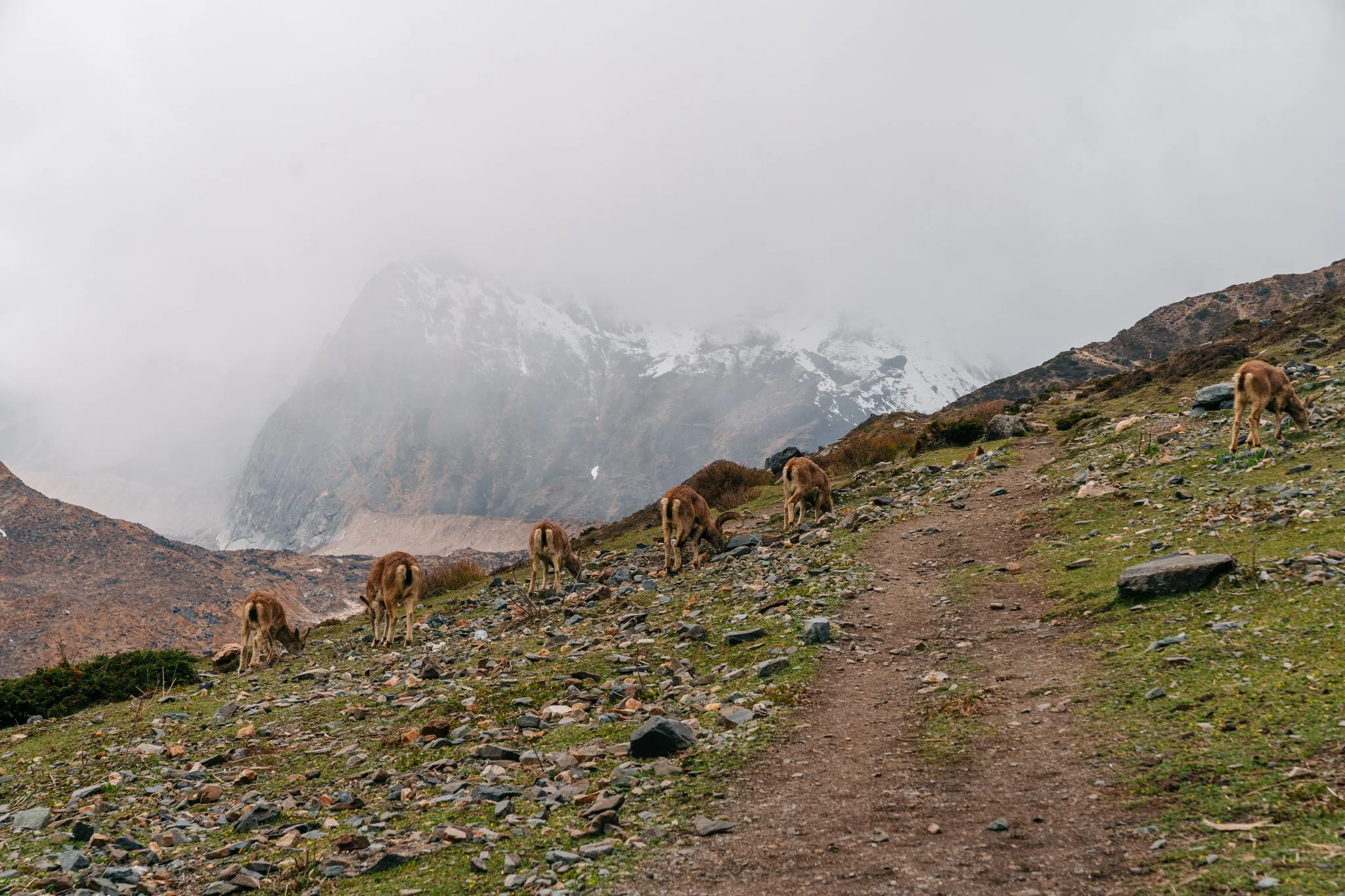
Blue sheep on the climb to Dharamsala. We were the only humans they saw all afternoon.
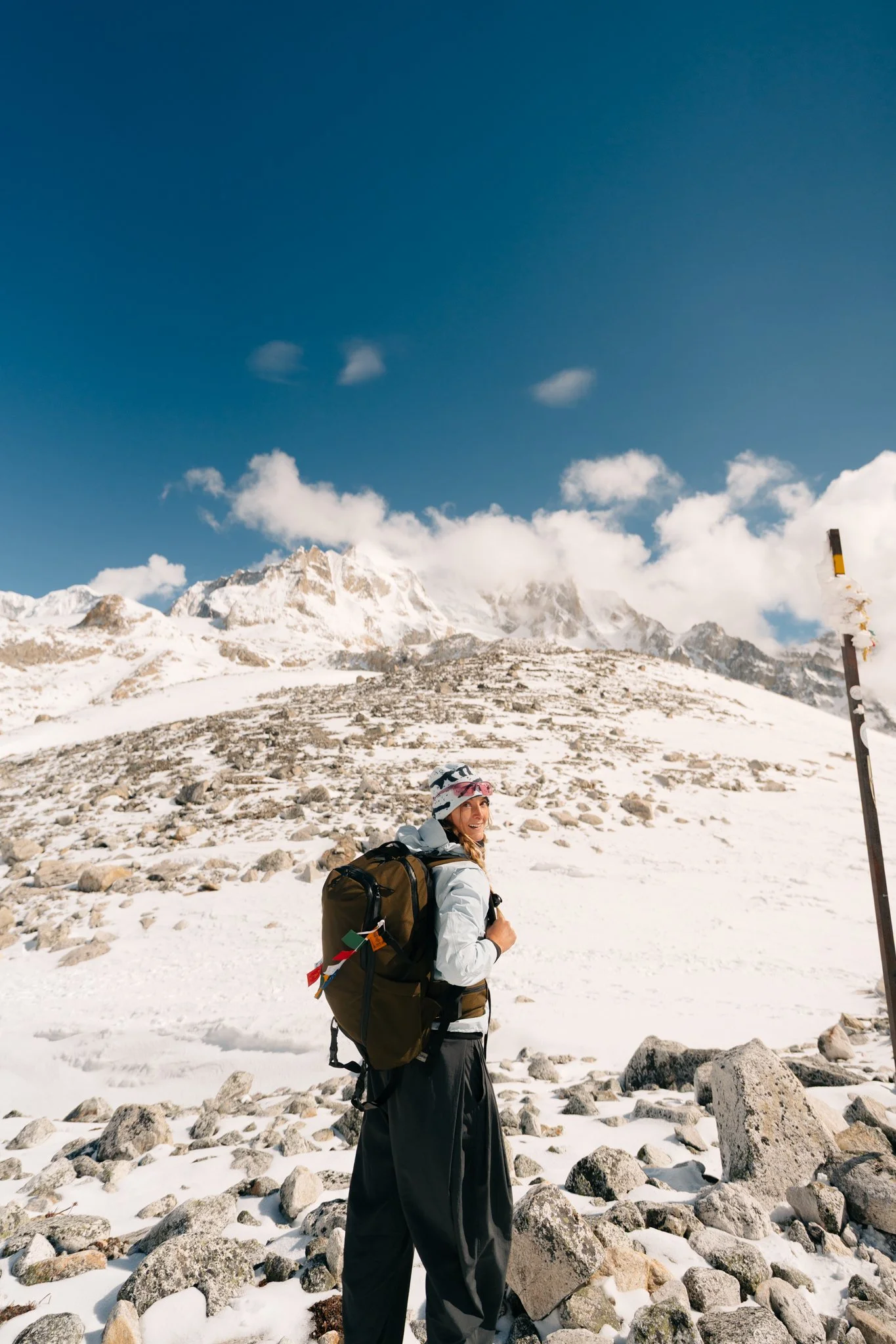
DAY 8: Larkya La Pass → Bimthang (~10 miles, 75.6 cumulative, 23,113 ft)
4 a.m. at Dharamsala. The moon turned everything to daylight.
3 A.M. and a Sky Full of Moonlight
3 a.m. wake-up. I'd been packing my bag for 45 minutes when I stepped outside. The fog from the night before was completely gone. The moon was bouncing off the surrounding mountains so brightly that the whole basin looked like daylight. I literally said "oh my god" out loud. I set up my tripod and shot long exposures with my broken camera, composing through the viewfinder, no LCD to confirm anything. Some of those photos look like they were taken in the middle of the day. You can see the green grass. You can see the sharp blue silhouettes of mountains. You can see headlamp light trails of trekkers ahead of us already moving up the trail.
We started at 4 a.m. I cruised. I passed everyone I encountered on the trail. By 5 a.m. the early blue hour was lighting up the mountains. By 5:30 the sun was golden. I shot some of the most beautiful photographs of my entire life on this morning, on a camera with a shattered screen and one lens.
The Climb
I'm not going to glaze over how grueling this was. I walked slower on the inclines than I had anywhere else on the trek. My legs were shaking after every five steps uphill. I had to stop constantly. But I kept moving. I kept telling myself: it's supposed to be hard. If it was easy, more people would do this. I came here for it to be hard.
I reached the top, Larkya La Pass at 5,106 meters, at 7:22 a.m.
The Pass
I started crying the moment I could see the prayer flags and the sign. Something I hadn't been letting myself feel for the past four days came up all at once. I am alone. I did this by myself. I wasn't sure I could do something this hard. I never imagined I could do something like this. The prayer flags and the sign at the top felt like permission to stop, look around, and feel proud.
The summit was full of other trekkers. People had left Dharamsala anywhere from 3 to 4:30 a.m., so we all clustered at the top around the same time, taking turns photographing each other in front of the prayer flags. Nobody was annoyed. There was so much camaraderie that I genuinely loved being one of many. I was so happy to see other people happy.
I took a photo with Jiwan and Das. I tried to take in mountains in every direction. I couldn't name them all, and Jiwan didn't push. I ate nothing. I just kept moving.
5,106 meters. 7:22 a.m. The most ridiculous I have ever felt to be alive.
The Porter Reflection
Standing on the pass with Das, who had carried my main bag for the entire trek up to this point, I had to put down on paper how I felt about porters. Das's bag for me was relatively light, about the same weight as the camera bag I was carrying. But typical porters carry up to five times what their clients carry. They tie a rope around the bottom of the bag, attached to a cloth headband, and carry the weight with their head and neck. They were born in these mountains. They do not complain. Not for a single second.
Meanwhile here I am with my $400 Arc'teryx jacket, my $30 sleeping bag liner, my fancy waterproof boots, my obsessive pre-trip Strava research, and I'm gasping next to a man wearing sneakers who's carrying twice as much as I am.
Tip your porters generously. You cannot pay them enough.
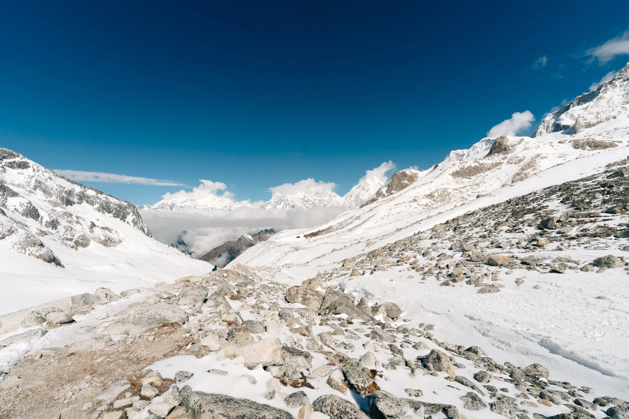
The Descent (and the Crampons I Should Have Put On Earlier)
The descent from Larkya La is long, snowy at first, then a brutal drop of about 1,500 meters down to Bimthang. I had been carrying crampons the entire trek. I should have put them on the moment we crested the pass. I didn't. I made it about halfway down before I slipped on the snow, took out Jiwan with my fall, and finally said, "Yeah, I should put these on."
Jiwan had been watching me handle the snow and said, "I've never seen anyone not from Nepal walk in snow as well as you." I had to keep reminding him I grew up in the Midwest, where it's cold and icy and you learn how to walk on ice as a child. He kept trying to make me put my mittens on or zip up my jacket, at some point I was like, "Brother. I've been in cold weather. I know when to put my gloves on." I love him for it.
By the way: as I descended, I stripped down to my Helly Hansen base layers because the sun was so warm and bright. Reapply sunscreen constantly on the way down. I wore these sun glasses. Snow reflects UV light back up at your face. The sunburn mustache is real.
Butt-Sledding with Das
And then in the middle of all this physical seriousness, Das became a silly goose. There were sections of soft, untracked snow, and Das just sat down on his butt and slid. For a long stretch. He carved a clean butt-print groove into the slope. I followed. We probably saved five or six minutes of hiking, and it was unironically a highlight of my day. I love him.
Boulder Fields and Bimthang
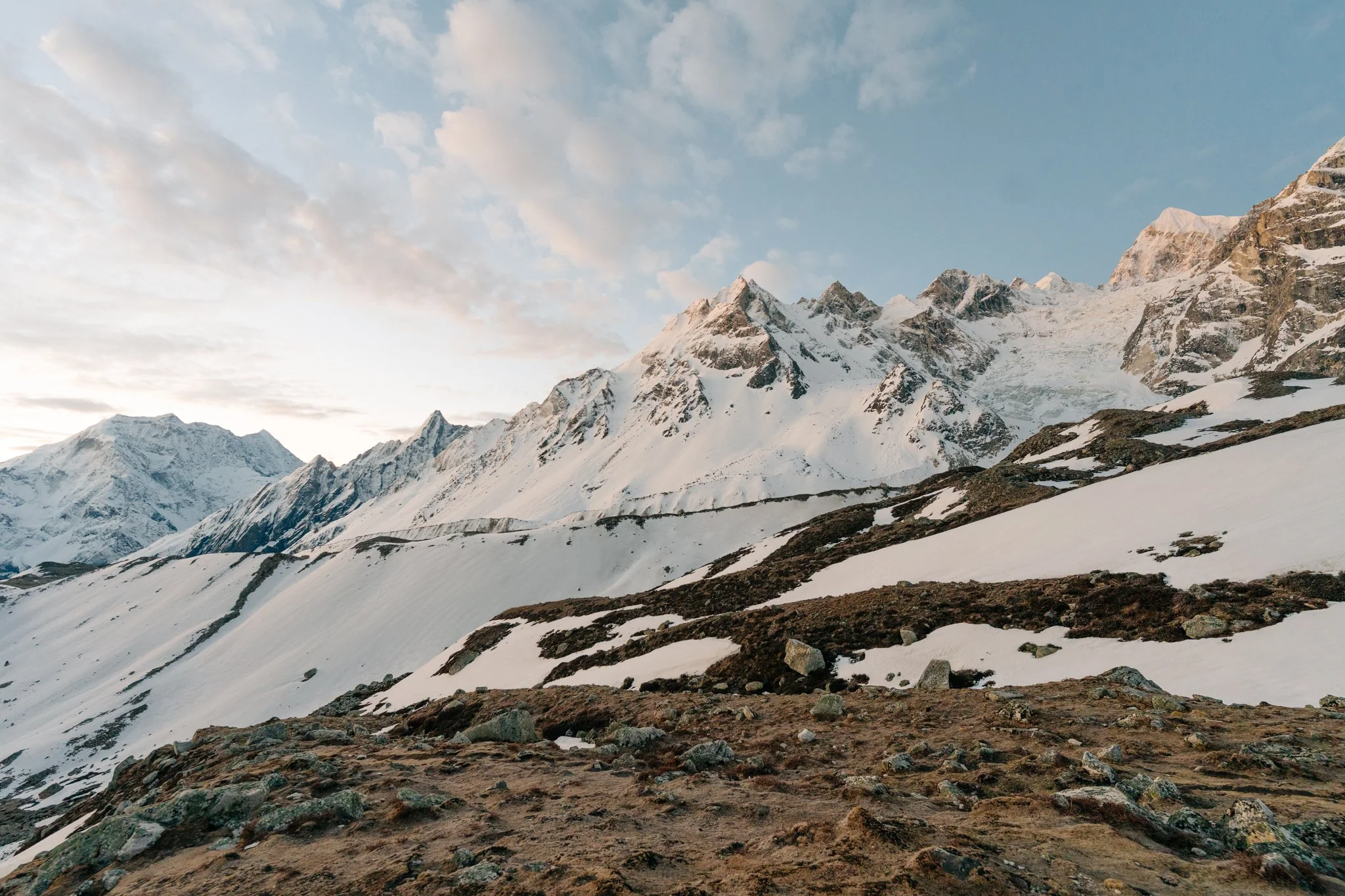
The snow gave way to a massive boulder field covered in moss. I felt like I was inside the movie Brave. The terrain on this trek changes so radically across so few hours. We descended into Bimthang, where the fog was thick on arrival but cleared just before sunset. From the village I could finally see Manaslu and the surrounding peaks unobstructed for the first time in days. They were absurd. They were the reason I came.
End of day: 75.6 miles, 23,113 feet of elevation gained.
I taught some of my trail friends how to play the card game Kemps in the common room, with an electric high-morale energy in the air. Hot shower. Quick dinner. Popcorn, apparently a common teahouse treat, and one of my favorite things I ate the entire trip. I learned at altitude that even when you're not hungry, you're still hungry for popcorn. Bed by 9. 5 a.m. wake-up.
Our teahouse row at Bimthang. The most beautiful place I have ever taken my boots off.
DAY 9: Bimthang → Dharapani → Besisahar → Kathmandu
The Rhododendron Forest
5 a.m. wake-up. Out of the village by 6. Most other trekkers were taking a rest day after the pass, but I was feeling great and we wanted to compress the trip and get back to Paige in Kathmandu.
The descent that morning was a complete shock. Foggy moss-covered forest, magical light, and rhododendrons in bloom. Cherry blossom pink, deep punch red, occasional purples and whites, hanging from every cliffside, all along the trail, in clusters that reached up and out into the distance. Nobody had told me about this part. It was unexpectedly the most magical hour of the entire trek. I wanted to stop every two seconds. Jiwan said spring had come early this year, he mentioned global warming on the trail probably a million times. The Himalayas are changing fast.
By 7:40 a.m. we'd reached a small village with bright yellow tea huts. Fruit plate. Black tea. Onward.
From snow at sunrise to old-growth rhododendron forest by mid-morning. The Manaslu Circuit's ecosystem shifts faster than you can believe.
The Langur
I'd been hoping to see wildlife the whole trek. We turned a corner on the trail and I saw a long, fluffy, gray-white tail running away into the trees. For a split second I thought: snow leopard. It was actually a Nepal Gray Langur, also called the Himalayan Langur, black-faced, fluffy-tailed, lives in cold high-altitude regions. It vanished up into the trees almost instantly. We were so early on the trail that day that I think I caught it because there were no other people around. Magic.
Dharapani — The Trek Officially Ends
We arrived at Dharapani with my Strava reading 87.37 miles and 23,892 feet of elevation gained. I sat down in a little tea hut, took my boots off, put my flip flops on, and felt my feet thank me.
Dharapani. 87.37 miles. The trek officially ends here.
The Australian Family Jeep Drama
I have to tell this story because it's stuck with me. There was an Australian family on the trail, mom, dad, daughter, who'd done the full 15-day version of the trek. We'd briefly said hi to them on the trail. They were nice. We beat them to the trail end at Dharapani by maybe twenty minutes. Jiwan called ahead and arranged for our group to share a jeep with them for the three-hour drive to the next village. The plan was set.
The family arrived. Walked past my tea hut without saying hi. Got directly into the jeep.
I went over with my bag. "Hi! I think we're sharing this jeep?"
"There's no room."
"I think there's a misunderstanding, we're happy to hold your bags on our laps, sit in the back, take any space."
The father started looking at his guides. His guides were getting tense. He told me, "I have a really good relationship with these guides, I don't want to mess this up." I said, with all due respect, "You're paying for this jeep, but we'll split the cost with you. Can we please join you? It's only three hours."
He said no. He closed the jeep door.
I would never. Oh my god, I would never.
But fine. They'd been on the trail for fifteen days. Maybe they had this whole drive in their heads as the moment they finally got privacy and comfort. Maybe I was the unwelcome stranger. I tried to give them benefit of the doubt. There happened to be another jeep going the same way, we hopped in, no problem, no drama. Karma is real, I guess.
Point of View Restaurant
Around 12:30 p.m. we stopped at a cliffside village for lunch at a place called Point of View Restaurant. There was a waterfall framed perfectly through the windows of the dining room, across the valley, framed like a postcard. This place needs to be on people's bucket lists. The only thing on the menu was dal bhat. It was excellent. I was finally hungry again now that I was below altitude. Highly recommend pulling over here.
The Death Toll Road
The road from this section to Besisahar is the most extreme road I've ever been driven on. It hugs the cliff sides on bends so tight that two cars cannot pass, when a truck came toward us, we had to back up and find a spot wide enough to let it through. I felt like we were going to fall off the edge multiple times. Jiwan told me casually that this road was built about ten years ago, and over ten people died during construction. I felt very small and very lucky.
Bus Back to Kathmandu
We dropped into Besisahar, the first proper town I'd seen in over ten days. Jiwan and Das chatted with a bus driver and somehow secured front-row seats on an air-conditioned vehicle for the nine-hour drive back to Kathmandu. The contrast with the chaos public bus on the way out was unreal. Hire well-connected guides.
I listened to podcasts. I edited Instagram stories. I sat in my own private cocoon of clean air-conditioned comfort. Before I knew it, I was back in dusty, smoggy, glorious Kathmandu, walking back into Roadhouse Hotel Thamel, the same hotel where this whole trip had begun, and reuniting with Paige.
DAY 10: Kathmandu Day → Flight Home
The Best Shower of My Life
I want to talk about the first shower after a 10-day trek and a 10-hour bus ride. Surreal. The hotel provided towel. A margherita pizza I could order from the restaurant downstairs. The ability to dump my entire backpack onto the floor and reorganize it without shivering. Life at home is so easy. I'd been taking it for granted for too long. This trek will fix that for you.
Roadhouse provides breakfast, coffee with brown sugar, eggs, bread, fruit. We ate, then walked out into Thamel. The shops here are spectacular. Felted handmade everything, ornate cushions, prayer flags, jewelry. I bought a felted yak-and-stars baby mobile for my niece for 1,600 NPR (about $10). Worth every cent.
Four Stories Café
A friend had recommended a café called Four Stories, and I'm passing the recommendation forward. Go to the second floor. They have floor seating on big fluffy cushions, an overhead sculpture that ripples in the wind, a window view over the street, a huge matcha menu, hojicha drinks, and a real food menu. Everyone there was an expat or nomad or international traveler. After ten days in remote villages, the international café energy was wonderful.
This is where Jiwan showed up to take Paige to her last rabies shot. And here is the best small moment of the whole trip. Remember that Jiwan asked the village in Samagaon if anyone made yogurt? He never forgot. On his way to meet us at the café, he stopped at a rural village and bought TWO huge clay pots of homemade local yogurt, the famous traditional kind that gets sold cold in the pots, and brought them to me and Paige.
Each pot was the size of a half-gallon ice cream tub. We had to gently tell him we couldn't possibly eat them all. He said, "Oh, I had a whole one for breakfast." We were like, what is wrong with you, that's amazing. The yogurt was incredible. So thoughtful. So Jiwan.
The Noodle Factory
After checking out of Roadhouse, Jiwan took us to a noodle restaurant that serves noodles from his factory. He ordered three preparations: chicken, beef, and one vegetarian for me, bright white chewy noodles in a spicy sauce with carrots, green onions, and peanuts. One of the best things I ate in all of Nepal. I cannot stop thinking about that sauce. The noodles reminded me of udon, almost translucent, perfectly chewy, hand-pulled.
Then we went to the factory itself. Jiwan walked us through one of his warehouses where the noodles were drying, long pale strands hanging in perfectly organized rows, climate-controlled, very clean. We saw the final packaged product on shelves ready for delivery. I'd watched this man cross 5,106-meter passes on foot and now I was standing in the warehouse he built.
It started pouring rain. Jiwan brought us up to his apartment above the factory. We met his wife. We met his daughter. We met his father. We sat on the floor for two hours drinking black mint tea and eating popcorn (popcorn again!) and reminiscing about the trek. Jiwan kept telling stories, his daughter played around us, his wife laughed at his stories. This was the perfect ending to the whole experience. I cannot recommend this man's tour services or his noodles enough.
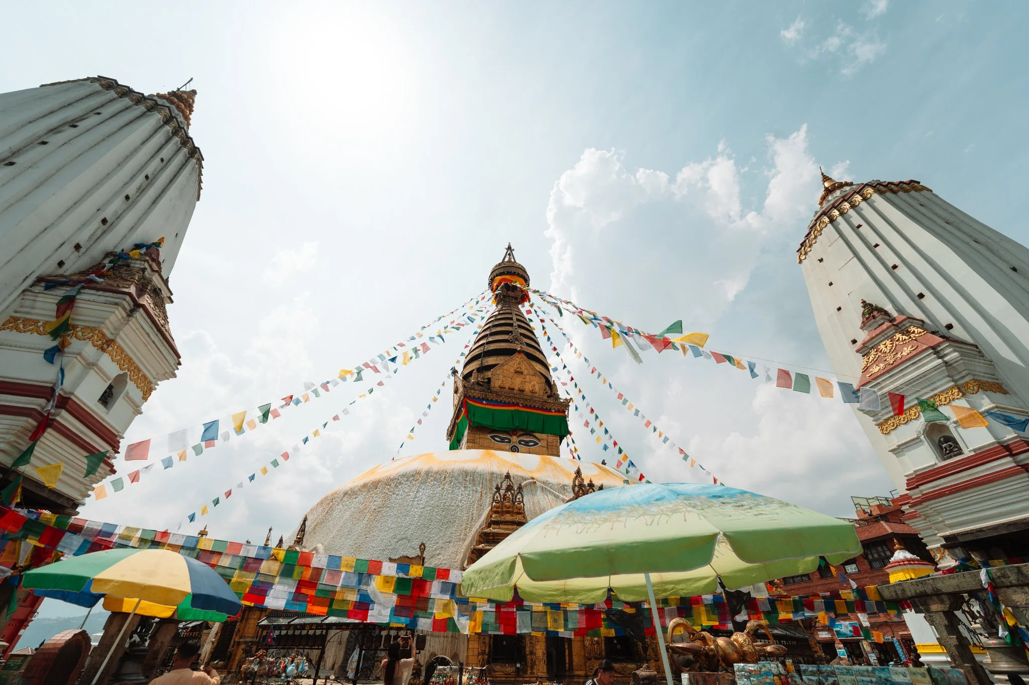
Monkey Temple (Swayambhunath)
We had time for the famous Monkey Temple, also known as Swayambhunath. The view from the top of the temple stairs is one of the best in Kathmandu, you can see the entire city laid out below, all the rooftops, the river, the mountains beyond, with the giant golden sculpture of the temple framing every shot. I shot a lot here. (On my broken camera, holding the lens to the body manually so it would still focus. Nine days and I was still rigging it together.) I bought a $3 ammonite from one of the gift shops, I love rocks.
Big warning about the monkeys: they are not pets. They are not docile. There are so many people around that you get a false sense of safety, but these monkeys are absolutely capable of biting and scratching. I tried to take a photo too close to one and it lunged at me. Do not bring food. Do not get close. The last thing you want is to be Paige's situation, but with a monkey.
Pilgrims, pigeons, and prayer flags. Kathmandu at its most itself.
Boudhanath Stupa
Next stop was Boudhanath Stupa, one of the largest Buddhist stupas in the world. It was pouring rain when we visited, which was a shame, on a sunny day, the plaza is full of pigeons and you can frame iconic shots of the stupa with hundreds of birds in the foreground. I missed that one. Still beautiful even in the rain.
Final Dinner — Organic Smoothie Bowl
Paige had struggled to find gluten-free food the entire trip, so we sought out a gluten-free vegan organic restaurant just down the road from Boudhanath. After ten days of barely eating at altitude, I came alive. I ordered shakshuka and pan con tomate. I think Jiwan was stunned watching me eat. I had not been able to eat in days. I shoveled it all in. So good.
Then we headed to the airport, Cathay Pacific back to Hong Kong (six-hour layover), Cathay back to LA, and Delta back to Salt Lake City. Home.
BY THE NUMBERS
Total trail miles: 87.37
Total elevation gain: 23,892 feet
Highest point: Larkya La Pass, 5,106 m / 16,752 ft
Hiking days: 9
Total trip days: April 21 – May 5, 2026
Trekkers per year on Manaslu: ~7,000 (vs. 30,000+ on Everest Base Camp)
Cost of the item that saved my trek: 250 NPR (~$2 USD) for a nail clipper Jiwan bought me in a village
THE FULL GEAR LIST
I'm building out a separate detailed packing post (with photographer-specific gear notes — what worked, what broke, what I shot the entire trek with after my Sony body broke), but here is my ride-or-die ShopMy collection with everything I packed:
HOW TO BOOK THIS TREK
I trekked with Ecuatraveling and I cannot recommend them enough. The trek package is $2,125 USD per person (minimum 2 people). It includes airport pickup, hotel in Kathmandu, all permits, full board on the trail, your guide, your porter, and private vehicle transfers. (Pro tip: if they offer you a public bus to the trailhead, opt up to a private jeep. You will thank me. Re-read Day 0 if you forgot why.)
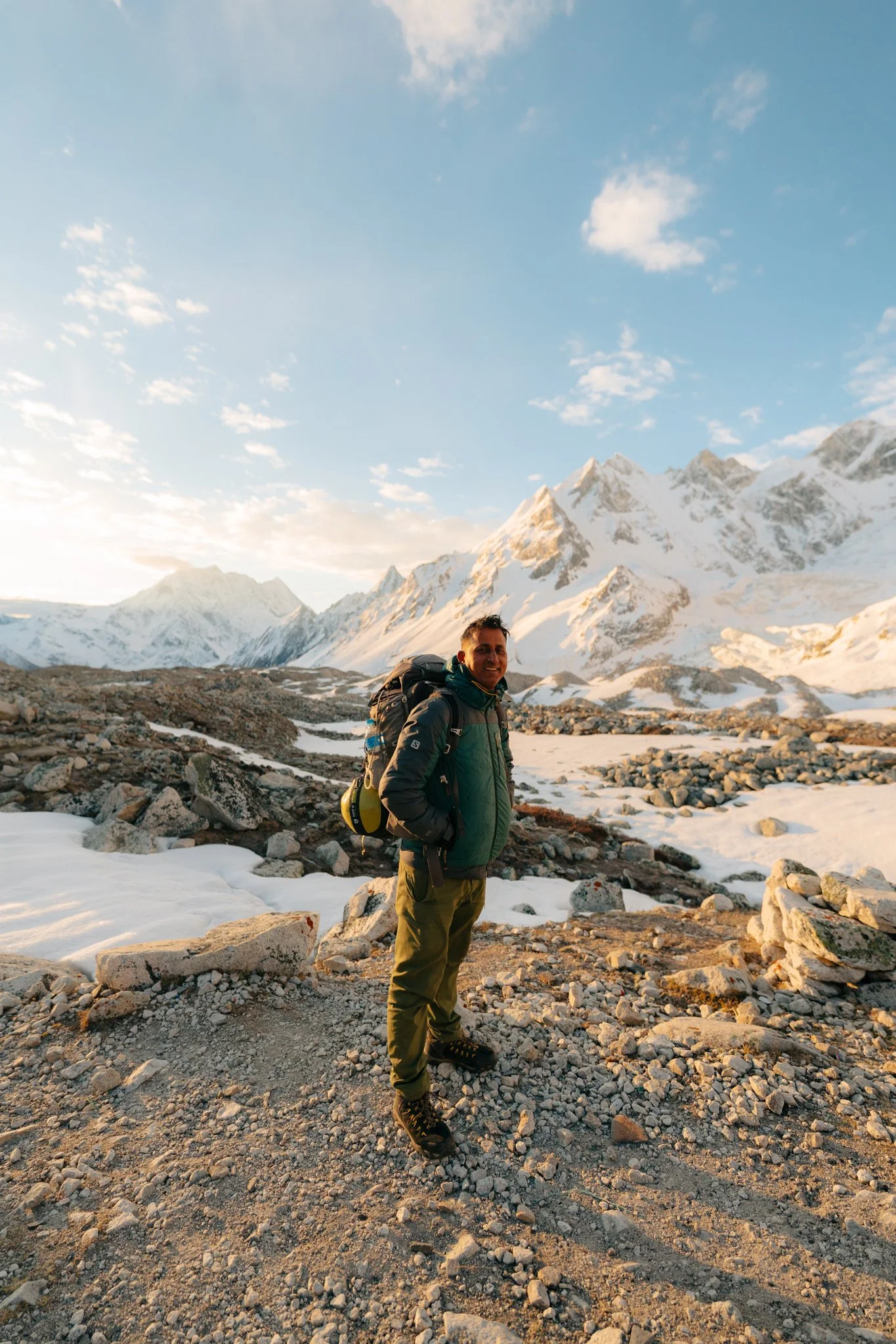
If you book with Ecuatraveling, ask for Jiwan and Das specifically, and tell them Karlie sent you. They are the entire experience. Jiwan has crossed Larkya La approximately 100 times and runs a noodle company in Kathmandu. Das has been guiding for eight years, is one of the kindest people I've ever met, and once butt-slid down a mountain pass with me. They will take care of you.
Detailed booking guide, what to look for in a trekking company, full insurance breakdown, and permit logistics will be in my upcoming booking post.
FINAL THOUGHT
Standing on Larkya La Pass at 7:22 a.m. on May 4, 2026, with prayer flags flapping over my head and Manaslu and Himlung Himal and Annapurna II in every direction, I cried for almost ten minutes. I came on this trek because I wanted to challenge myself. I never imagined I'd be capable of this. The mountain doesn't care about your insurance policy or your broken camera or the helicopter that took your friend home or the boots you sized wrong. It just stands there, completely indifferent, completely majestic, waiting for whoever shows up.
If you've been thinking about doing this trek, this is your sign. Go. Bring your fruit-packing guide, your $2 nail clipper, your Arc'teryx jacket layered under your $1.50 bodega poncho, your Diamox, your sleeping bag liner, your common sense about local dogs, and the willingness to be small in front of something very, very big.
I'll see you out there.
— Karlie
More On The Blog

This post contains affiliate links. Booking through my links supports this blog at no extra cost to you.